Day 12: Up and Over
As a sophomore at Amphi High School I would spend breaks in the school library, reading Arizona Highways and planning backpacking trips I’d take someday. A bit dorky. Now as I pass the trees on the trails I always dreamed about, I want to know what I’m seeing. I find this site in a few seconds and start studying trees. Still a dork.
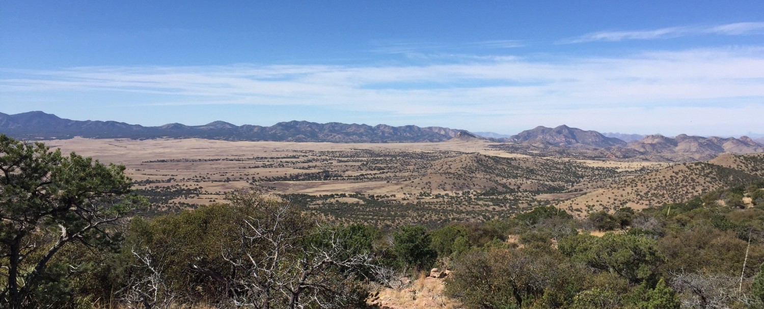
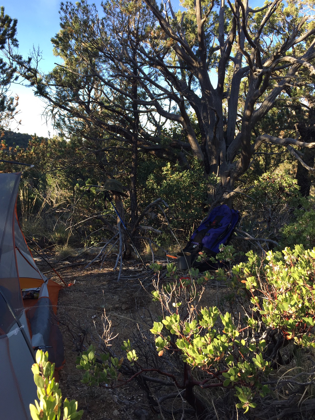
On the morning of the 15th I wake in my camp at about 6400 feet. I’m on a forested ledge in the Rincons with a view south over the Tucson Valley and (further) the Santa Ritas.
A large alligator juniper stands right by my campsite. My tent is surrounded by great clumps of manzanita, with twisted branches of red smooth bark and the small green leaves and the white flowers that hang in clumps like little sleigh bells. As I leave camp and hike north and up, I can hear the rush of Chiminea Creek deep in the canyon below me.
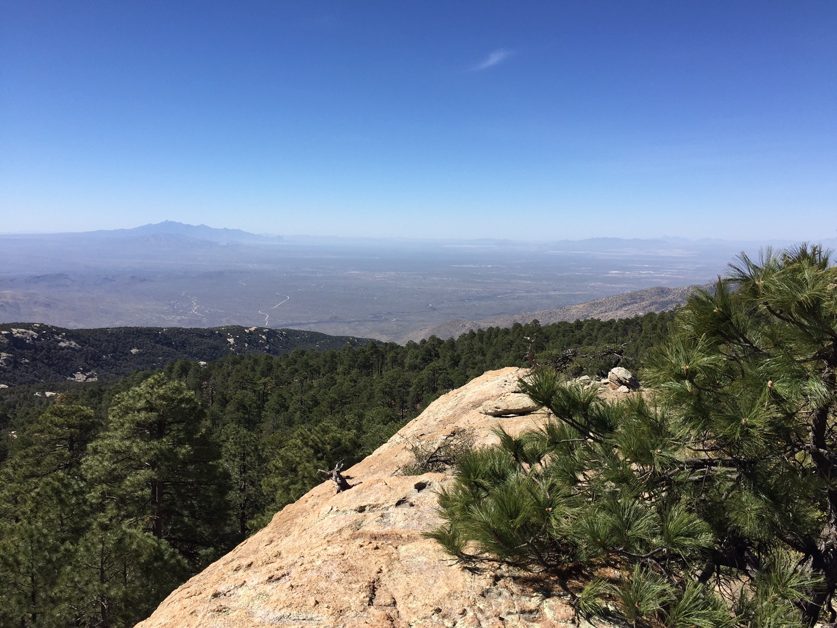
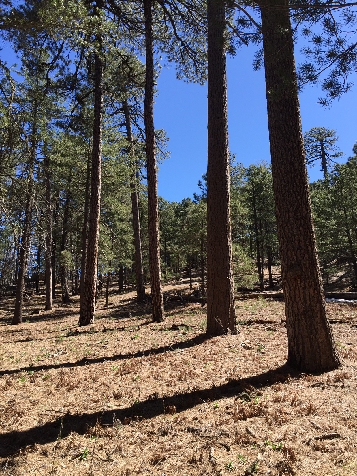
By midday I’ve hiked 2000 feet higher – enough to cross Chiminea Creek closer to its source. Now there is snow in the shady spots and the louder sound of water pooling under falls and rushing over boulders. I walk under tall ponderosa pine, and the trail grows faint and crosses a bare forest floor covered with dry needles and cones. The sound now is wind filtered by pine needles 50-60 feet overhead. Sounds like summers in Flagstaff. When I crest the mountain and start on the north slope I see aspen (not yet leafing) and thick, green fir trees.
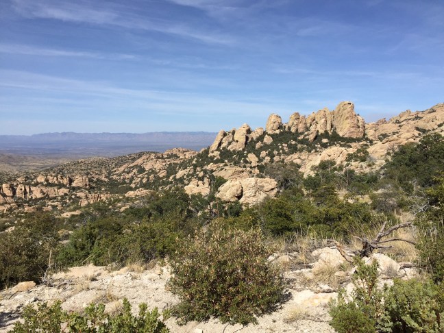
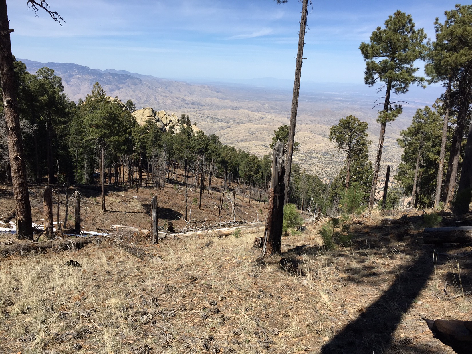
In the afternoon, the decent is rapid down the north side. The view is to the northwest and west – a whole new world to a Tucsonan. Due north I see the fertile canyons of Aravaipa Creek and to the west I see into the Gila Wilderness and New Mexico. I descend through boulders thrown around like giants playthings. The manzanita re-appears all around me. They are beautiful in both life (green leaves and red bark) as well as death (dry, twisted, grey and ancient). Scrubby little pines that could be apache pine or pinyon, and soon desert olive trees.
At the base of the mountains I cross Tanque Verde Creek. It’s full of clear, sweet water and feels like the border. Everything north of here is Redington Pass and, beyond that, the Catalinas. I make camp on the night of the 15th somewhere in the pass, setting my tent somewhere around mile 151 amongst the tall grass and mesquite trees.
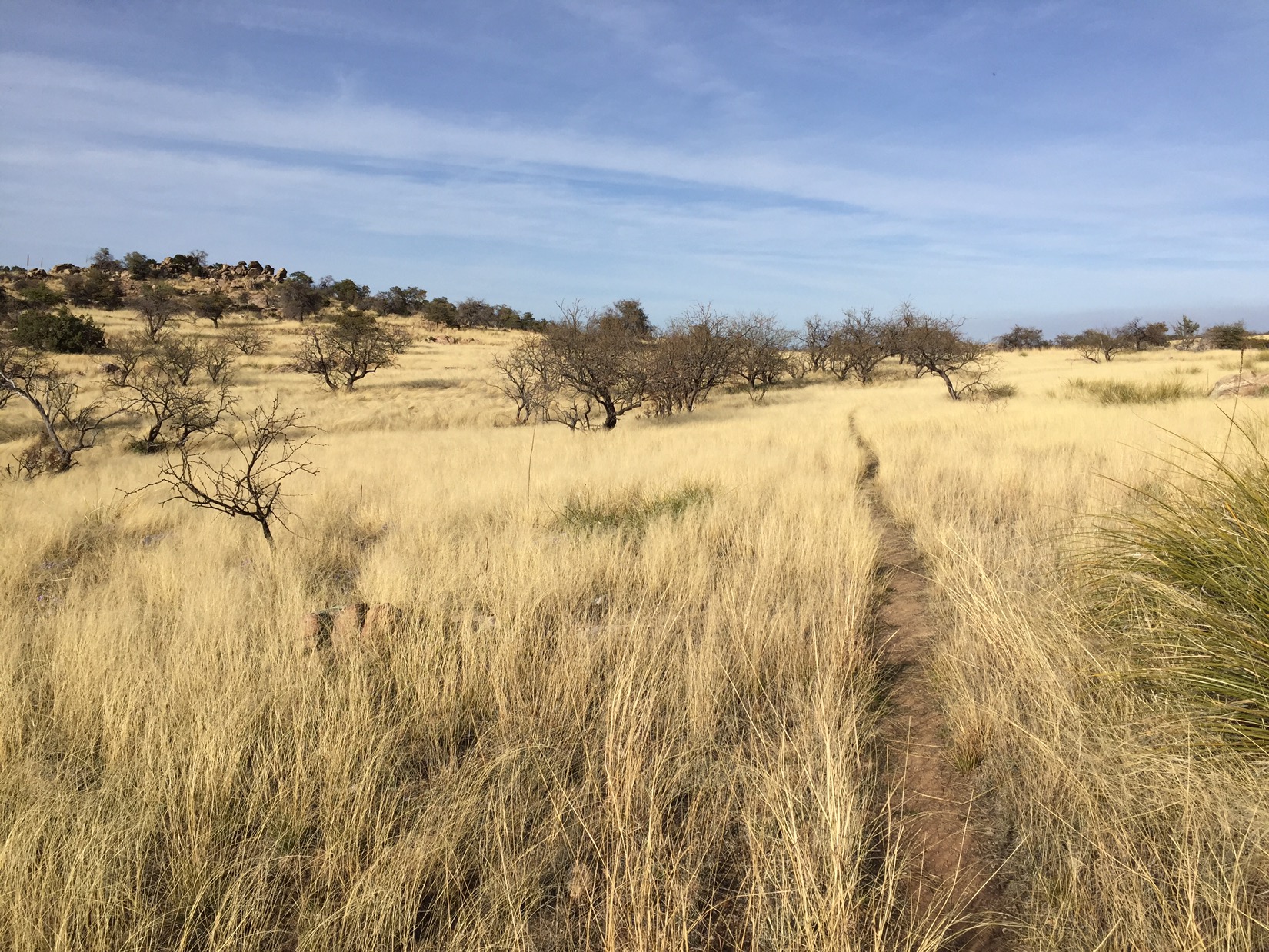
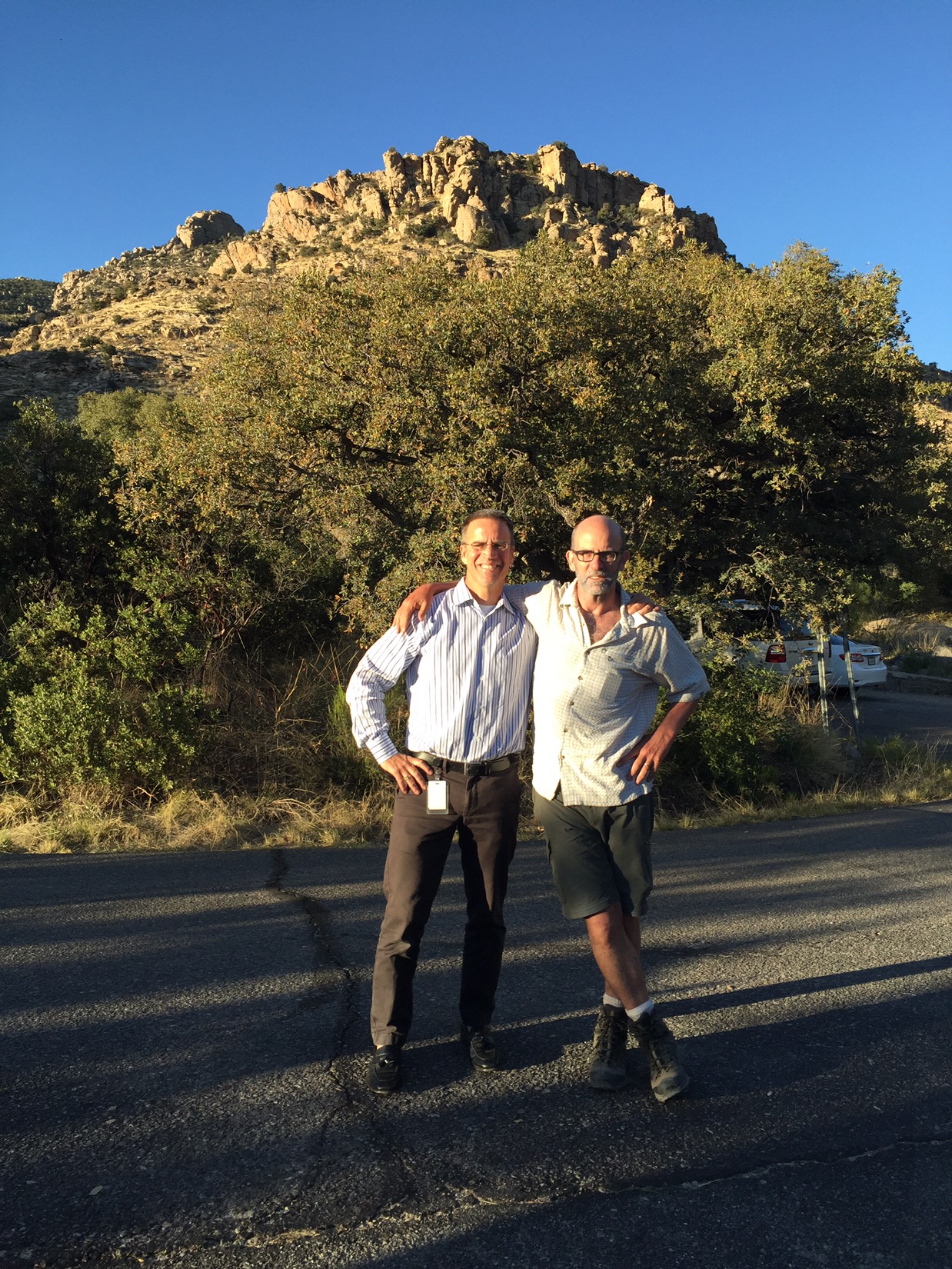
My final day of hiking is spent climbing out of Redington Pass, passing juniper, sycamore and the occasional Cottonwood whenever we cross a perennial creek. Cottonwoods with bright green leaves that stand out so clearly in the desert: their roots are the only source for Hopi kachinas carved the traditional away. I pass horny toads, cattle, horses and roadrunners. Fittingly, the last mile is the hardest. The trail gains 1000 feet in a mile and crests above Molino Basin Campground. Cresting not only gives me relief from climbing, it opens up the next chapter in the trek. On the other side of the hill I see the Catalina Highway, snaking 20 miles up from the valley floor in Tucson to the Mt. Lemmon at the top of the Catalinas. I descend into the campground where Chris picks me up for what’s turning out to be the celebratory dinner of the AZT: enchiladas and beer.

Thanks for sharing Michael! What an adventure! Happy for you my friend!
LikeLike