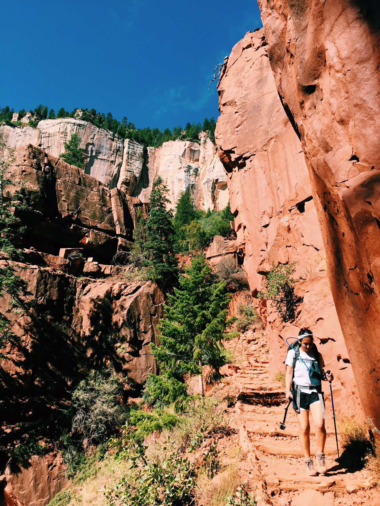
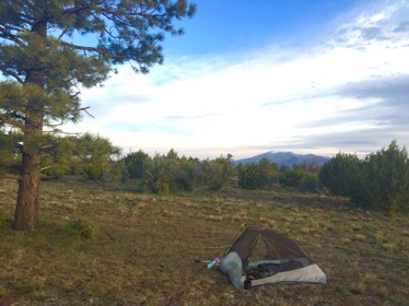
Emma and I break camp and do the easy walk to the North Kaibab Trailhead by 8:30. Then we’re over the rim and into the canyon. Every half hour we pass down through another vegetation zone (aspens, pines, pinyon) and another cliff layer (white, grey, red). We walk quickly and easily, getting into the rhythm of walking with 30 pound packs. Because it’s so remote, there are almost no day hikers on this side of the canyon, and the few people we see mean business: rim to rim hikers, an ultra marathoner going rim to rim to rim (about 50 miles round trip) and a work crew laying stone underneath the trail near Supai Tunnel.
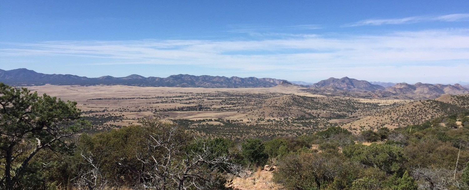
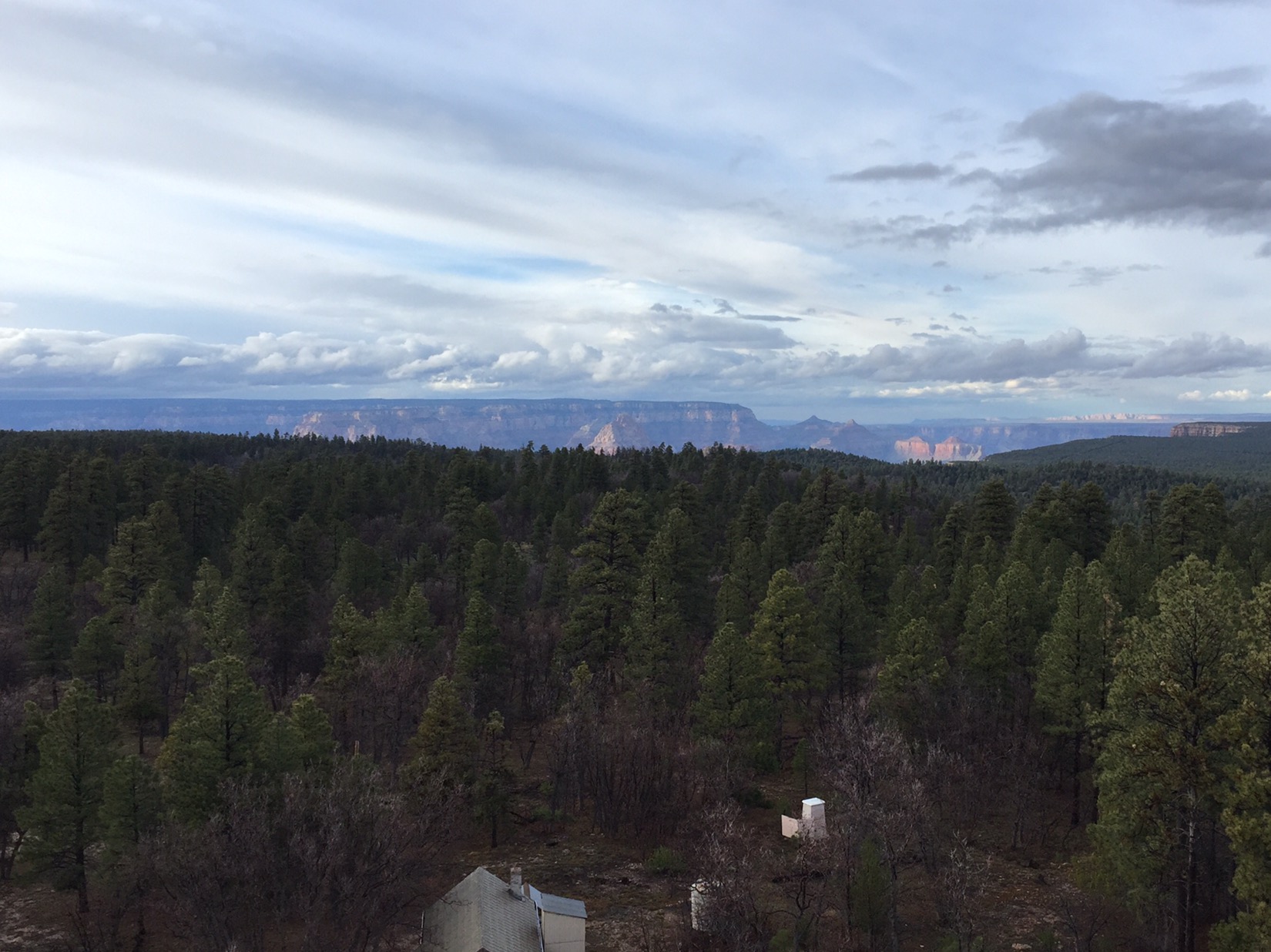
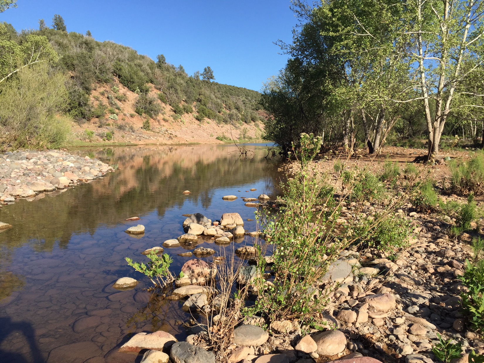
Below Supai TunnelLast summer, we had hiked to just below Supai Tunnel as a family, so from here on its all new territory. After 4 miles we pass Roaring Springs, which supplies drinking water to the North Rim above us. The water gushes from the bottom of the cliff to the east, then settles into a cold creek that parallels our trail for the rest of the day. Just after noon we’ve hiked 7 miles and reached Cottonwood Campground. The canyon opens up and the desert views are amazing.
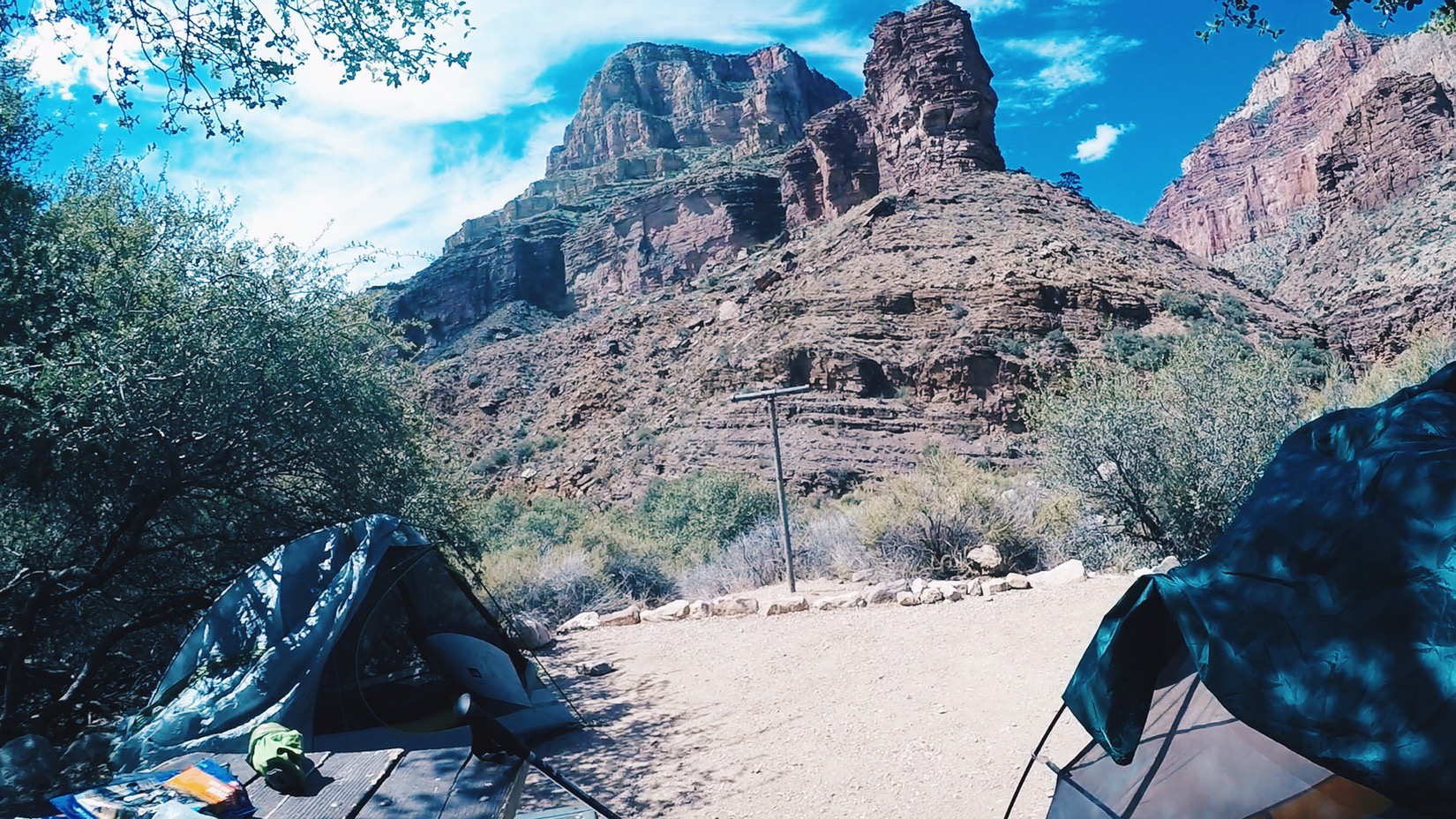
Near Cottonwood Camp
We grab one of 11 spots that are hidden off in the desert on either side of the trail. Our spot looks like it had its own set designer: a a big mesquite to one side of us and a view of the cliffs on the other. We set up our tents in the shade of the tree, hang packs from an iron post, then plunge into the cold, deep pools of Bright Angel Creek to escape the heat.
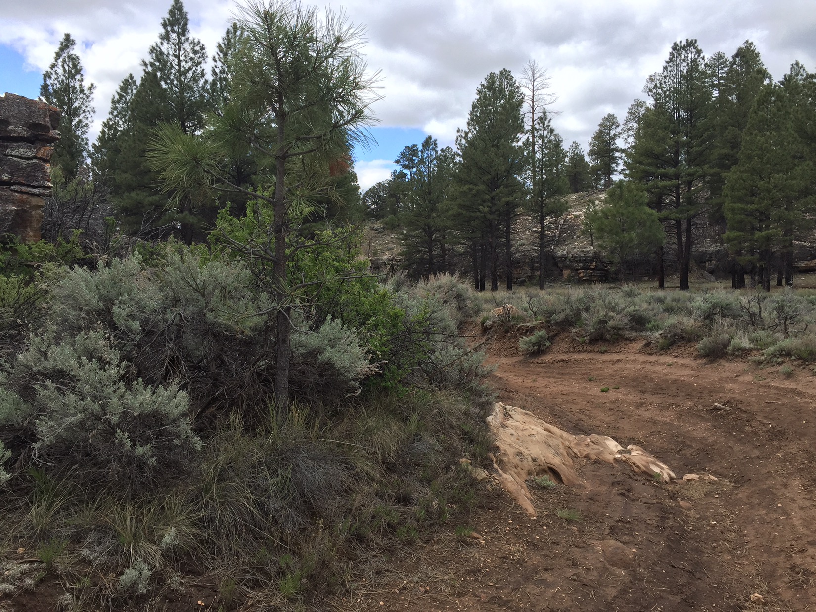
Finding shade
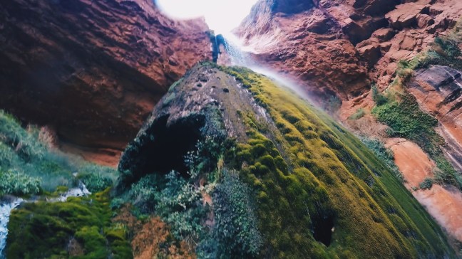
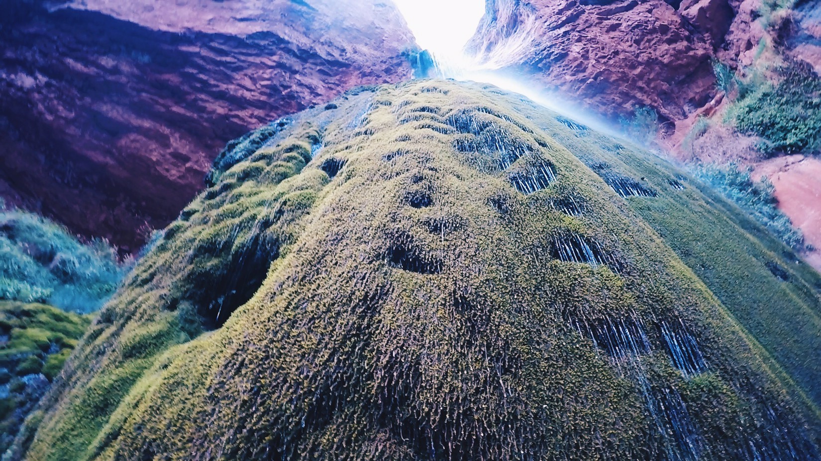
A good rule in the Arizona desert is to avoid doing anything in the sun between 10-2. The heat is especially brutal just after noon. It sucks the air out of everything. By 3pm, however, when the shadows start to lengthen, we go on a 3 mile side trip to Ribbon Falls. It is magic. It’s hard to explain the beauty. Minerals from a lacy waterfall have formed a travertine dome over the years where the water hits the canyon floor. The dome is covered with a delicate green moss and the water glistens like crystal as it trickles down into the pool below.
Below Ribbon Falls
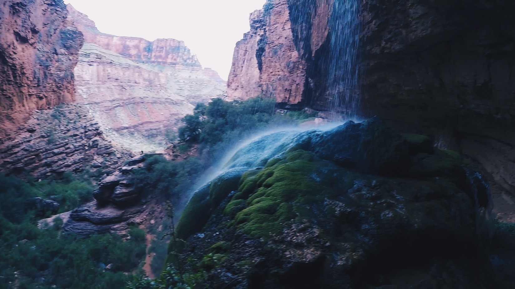
It’s also hard to explain the peaceful, grateful feeling of exploring this little canyon with Emma. Emma takes the trail up to the falls, and looks back over the canyon floor from behind the waterfall curtain. I take a different trail down, and swim into the cave formed at the base of the travertine dome. Time slows down.
Ribbon Falls
Back at camp that night, after slowly walking back from Ribbon Falls in the dusk, we feast on ramen noodles and freeze dried spaghetti. We love it. It gets dark by 7:30 and we’re tired by 8. We can see the lights from the Grand Canyon Lodge glowing at the highest point in the cliffs above and behind us.
By end of day tomorrow, I’ll have hiked 41 days on this trail.
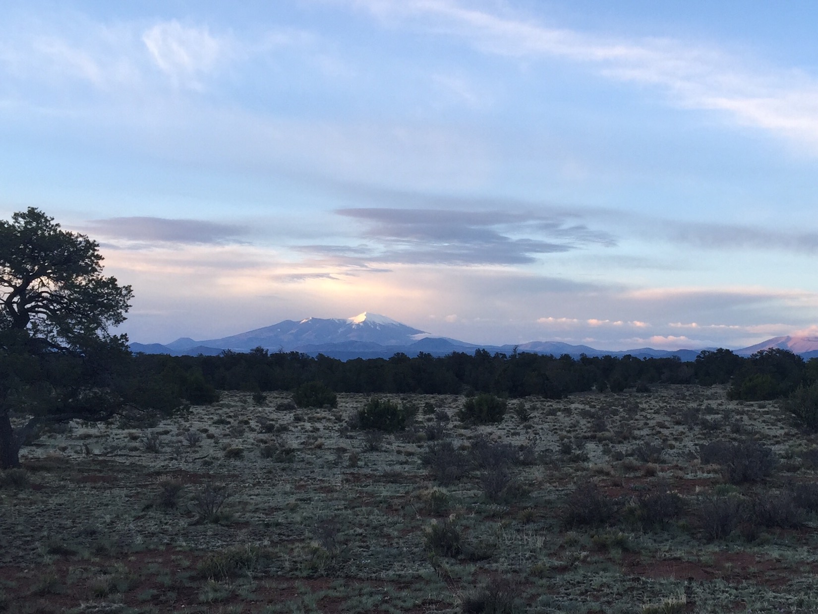
It rained again last night, a light calming mist. I take some time to dry tents and tarps on the pinyon trees around me, but by 7:15 I’m headed north again. I take one last look at the Peaks, finally free of clouds and glowing in the first light, then vow not to look back again. It’s been wonderful to meditate on that land, and that history, but for all I know, the furthest north our family story extends is Lockett Meadow in the inner basin of the Peaks. It’s time to turn my attention to the Canyon in the last days I have on this trail.
The Peaks at first light
My thoughts are on miles and water. Itineraries on a long hike are fluid, and I’ve decided to end this portion at the South Rim of the Grand Canyon. If I can hike those 52 miles by tomorrow afternoon, I can make a surprise return home two days earlier than planned. I’ll come back and hike the canyon itself in September with Emma, which will complete my mission in a beautiful way. I’ve already accomplished all I really wanted from this adventure, and I’m eager to get home to Chinita.
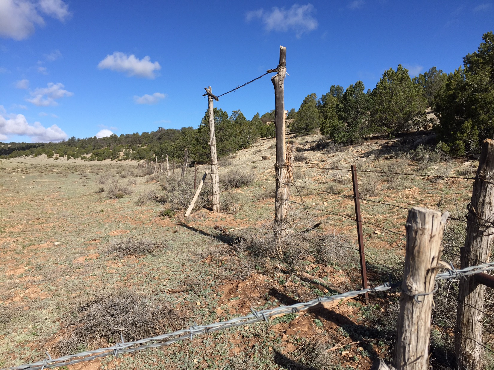
Corral at Lockwood Tank
In the meantime, water will be as daunting as the mileage. There are no springs or streams here, and I walk 12-18 miles between each cattle tank. But the air is cool and the distances are easy. The corrals and cattle tanks are like way stations on a pilgrimage: East Cedar Tank on the north slope of the Peaks at mile 632, the round trough and corral at Lockwood Tank at mile 651, the rusted red of Russell Tank at mile 662. I have always resented the highways that blow past the small towns of Arizona, severing the old connections between the town and the traveling. Walking between these old camps restores that slower narrative for me.
Lockett Lake near Grand View Lookout
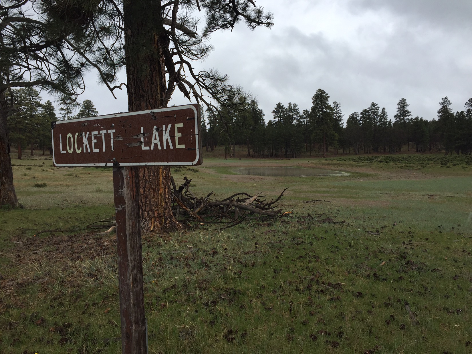
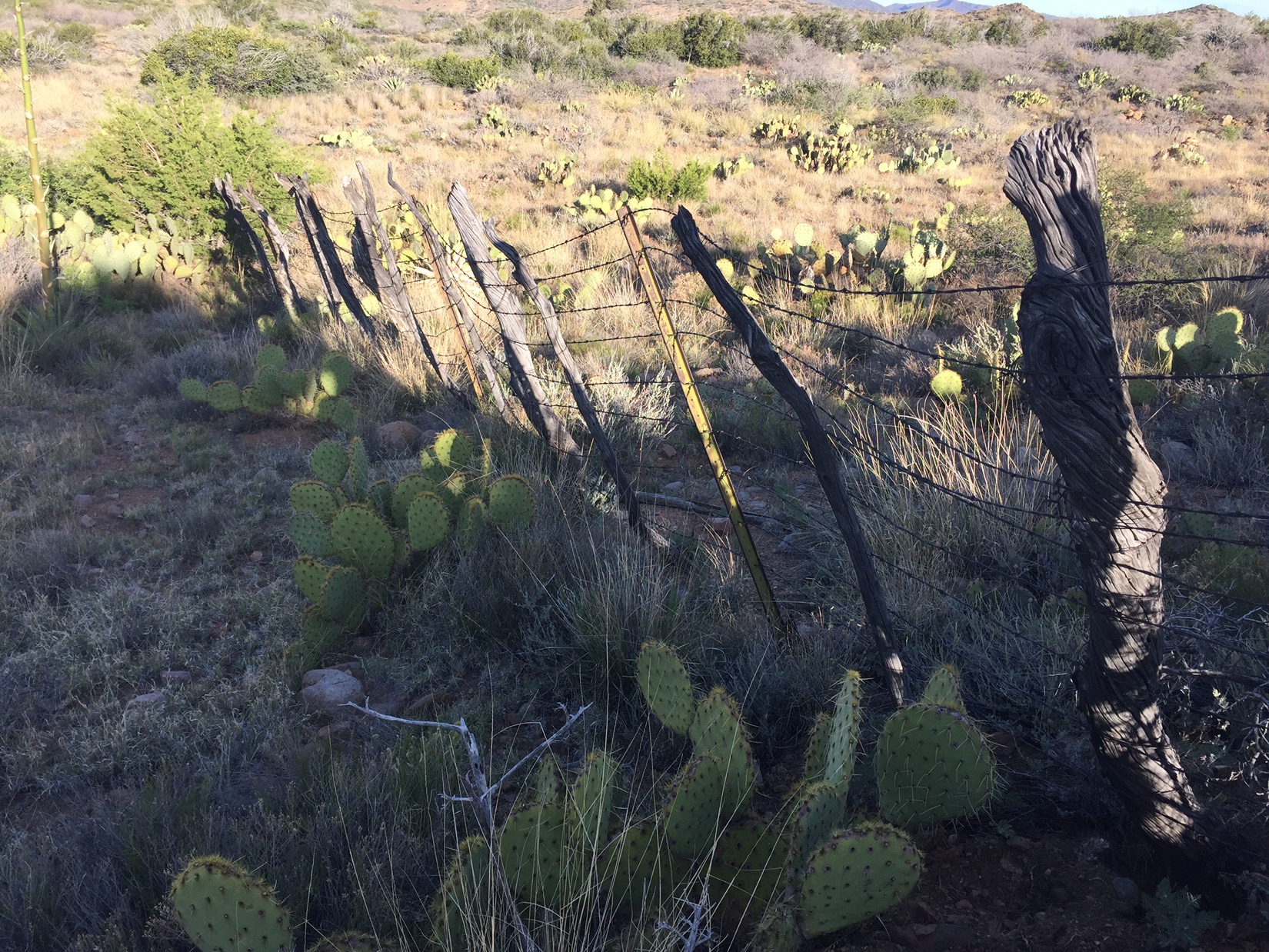
Maybe it’s the increasing lightness of my pack, but the knowledge this hike will soon end keeps my mood light. The landscape doesn’t change much, I walk through a constant rain, and the trail is muddy. But I’m good. Mid afternoon brings sunshine and two wonderful sights I didn’t expect. To spare my (now aching) legs, I leave the single track and instead walk on the forest service road next to it. Because I do this, I stumble upon Lockett Lake, which I never knew existed. Apparently Henry Lockett ran sheep here in the 1800’s, and when the creation of the national park forced him to leave, they named this lake after him. I see old barbed wire and fence posts and wonder if they are his.
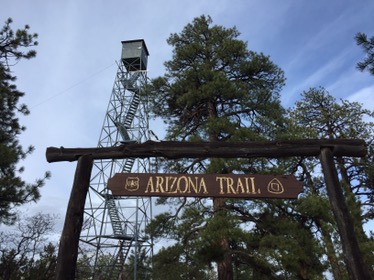
Grand View Lookout Tower
The second surprise comes later that afternoon when I hit Grand View Lookout. I had been looking forward to the water cache below this fire tower, but didn’t expect it to be open. I climb the long series of metal steps to the top, rewarded with cellphone signal and glimpses of the Grand Canyon about a mile away. After making my last Mother’s Day texts and calls, I climb down and search for a campsite. A herd of 18-20 elk thunders ahead of me in the fading light, and wild turkeys gobble yards from where I set camp in the dark. I hiked 32 miles today.
View of the Canyon from top of Grand View
In the morning I’m up quickly and out. It’s a big day. I have to hit Grand Canyon Village by 3 if I’m to make it to Phoenix – and a flight home – tomorrow. I walk through small canyons that drain into Coconino Wash, which in turn drains into Bright Angel Wash, which after a mile spills dramatically into the Grand Canyon itself. I’ve been to the South Rim dozens of times in my life, and I’ve always wanted to approach it exactly this way.
Final steps before Tusayan
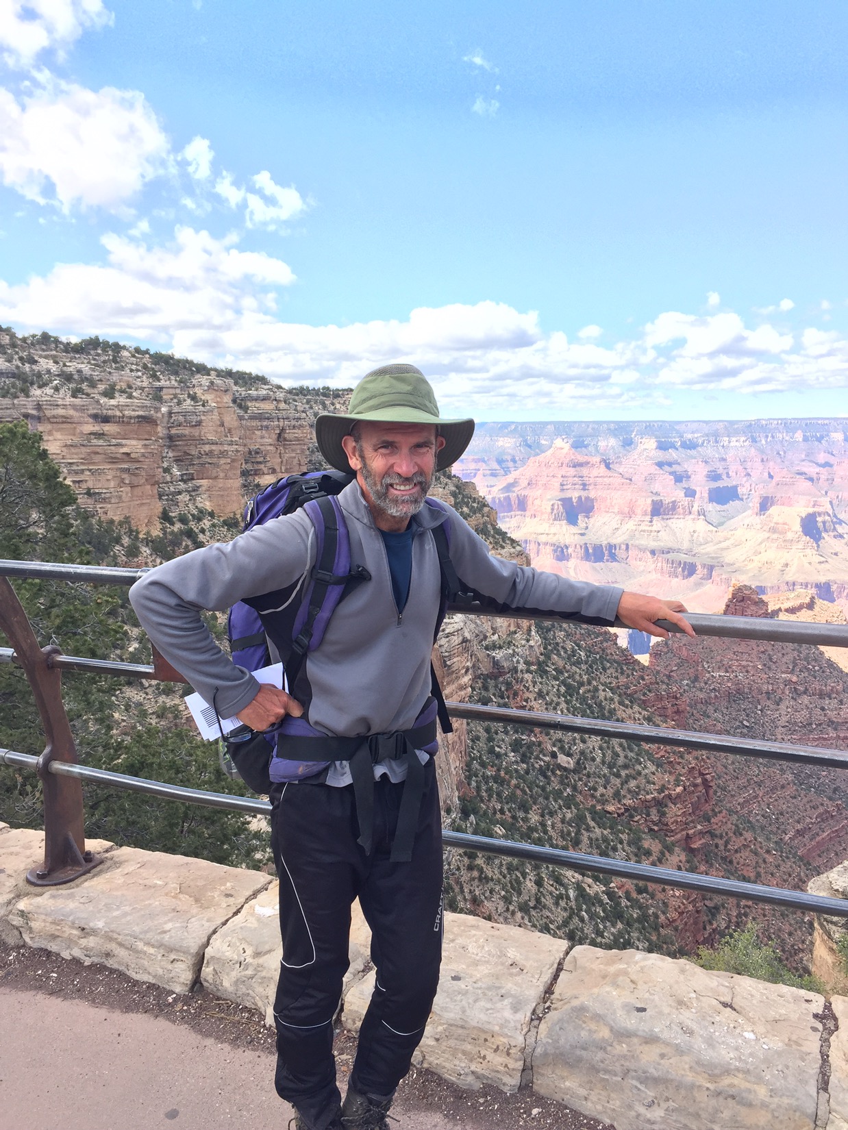
When I finally walk into Tusayan, and Grand Canyon Village beyond it, I’m shocked at the noise. The sight-seeing helicopters fly just above the tree line every fifteen minutes, and the tourist buses line up at the entrance station. At first I silently channel my inner Abbey (“Get off your fat ass and into the woods!”), then my inner Mathiessen (I think about his final night in Katmandu). My spell isn’t broken. The outside world only makes my inside world richer. My footsteps on the path sound thunderous. By three I’m at the South Rim, then in a shuttle bound for Flagstaff and then, finally, Chinita. My true home.
Took me 700 miles to grow a beard
Now, as I write this last post in the taxi from the airport home, what most sticks with me is not that last image of the Grand Canyon, as beautiful as it is. What sticks with me is that last stretch before Tusayan, when I walked on pine needles knowing that what was behind me was beautiful, what was in front of me was more beautiful still, but content to simply be in that moment right then. I think of that last herd of elk, barely seen in the forest twilight, hooves thundering, then vanished. The taxi pulls up to the apartment, and I hit send.
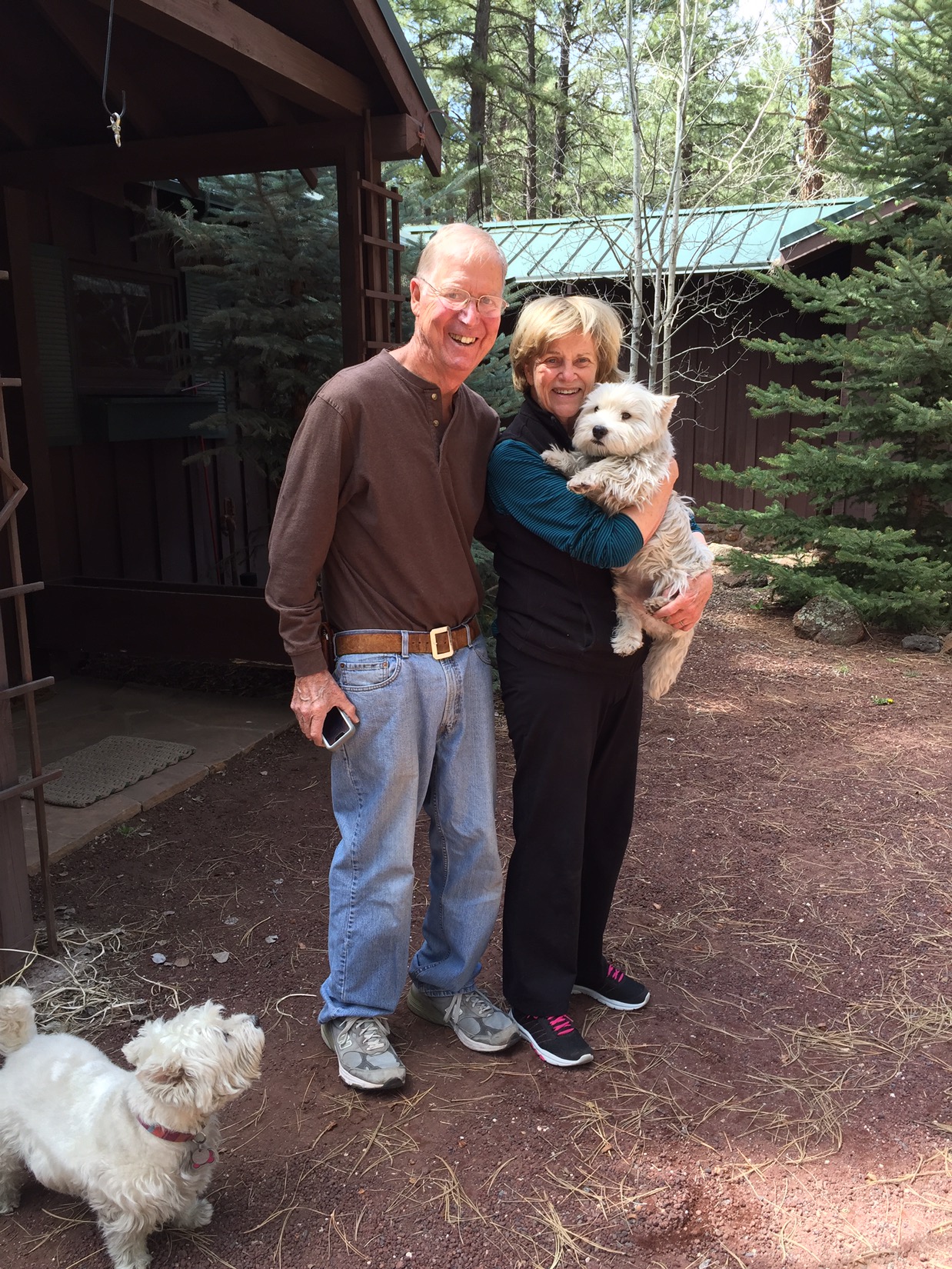
I wake before sunrise after an anxious night. Snow is forecasted late tonight and I don’t want to be at 9,000 feet when it comes. Mom makes me toast and Dad packs for their trip back to Tucson. I have only spent a few hours with them but without worries or deadlines time has slowed down. We sat outside last night drinking, talking and watching the light fade in the little canyon behind the house. It is harder to say goodbye this morning because I realize I won’t see them again on this trip. Dad drives me about a mile to the trailhead where I had stopped the afternoon before, and we say goodbye.
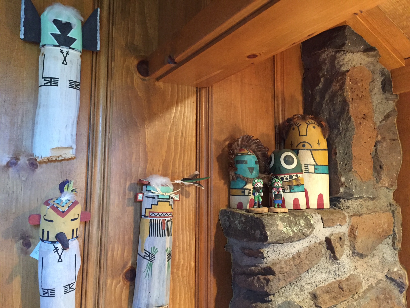
Kachina dolls in my parents house
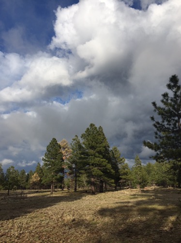
From Shultz Pass, I hike steadily up the south side of the Peaks. The forest is beautiful thick and green. Mature ponderosa pines then, after I cross the road to the Snow Bowl, fir and aspen and views back over Fort Valley. When the trail turns north and I close in on 9,000 feet, I walk into the sunshine of Hart Prairie. I have come here so much over the years that it is the mental image I recall when I need peace (or sleep). Frank Hart ran sheep here in the 1880’s. The western view over meadows and mountains stretches for a hundred miles. I look over old cattle chutes, Fern Mountain just near, Bill Williams Mountain far to the southwest, and Kendrick Peak to the northwest. It’s raining down there and while I sit in sunshine I can see the mists in the distance.
Hart Prairie with rain in the distance
The San Francisco Peaks are behind and above me. In 1629, 150 years before the California city got the name, the Spanish founded a Hopi mission in honor of St. Francis, then gave the same name to the Peaks. The Hopi believe the kachina spirits live here. The Navajo see the Peaks as one of four sacred mountains that mark their ancestral lands. I sit in the sun and eat lunch propped against a smooth warm stone, then walk again. After few miles I descend into Hansel and Gretel style deep dark forest, then end the day with good water from a long cattle trough below Kelly Tank. The cows don’t mind. I camp amongst cinder cones in the dormant volcanic field north of the Peaks, and beyond the worry of heavy snow.
Rain on the cinder hills (where I camped just an hour earlier)
I wake to sunshine and wonder what happened to the snow. Then it hits. Brief and beautiful. I quickly pack up before it gets heavier. I walk through a valley of red, brown and black cinder hills with sides covered in green grass and trees. The light is unique: the upside of being out here in a snow and rain storm. The clouds still swirl but out by me they are side lit by sun and thus pink and orange against the shockingly blue sky. The Peaks are shrouded in clouds and mist but I can see snow by Kelly tank where I was only a few miles ago. Those poor cows.
Looking north after decending from Hart Prairie
Below me the trail continues a long descent in elevation. I drop into what I always think of as Maynard Dixon country. The blue of the sky, the white of the clouds and the red and light green on the plateau stretching north. I take another look south: the peaks are still covered in clouds. I walk for hours in this open countryside. Each cloud is its own little rain shower and they mostly pass me and rain far away. I can see showers 40-50 miles away but I’m dry. I pass the cattle guards and fences around Tub Ranch and try to make good time but can’t help stopping every 15m to try to capture on film what I see all around me.
After the pickup left
I marvel that in this huge valley I have yet to see another soul. Then a white pickup truck motors along the dirt road from Tub Ranch. It slows and a middle aged Navajo man leans out, smiles and asks “water?”. There is a boy next to him in the cab and a dog in the back on top of a load of freshly cut wood. After I take the water they slowly drive up a canyon and I follow. Every time I glance back, the Peaks are still shrouded.
Pinyons above the mesa
Above the canyon the mesa is dotted with pinyon. It’s peaceful and I am as well. I listen to the remainder of the Snow Leopard and think about acceptance. It starts to rain softly around me. I’m happy and thinking about nothing but now. I notice the purple wildflowers, the smell of the rain, the rain drop that swings back and forth from the brim of my hat as I walk. I don’t stress and try to take the perfect photo or think about logistics. At dusk I remember to look back at the Peaks, and realize they were cloudless just 15 minutes before.
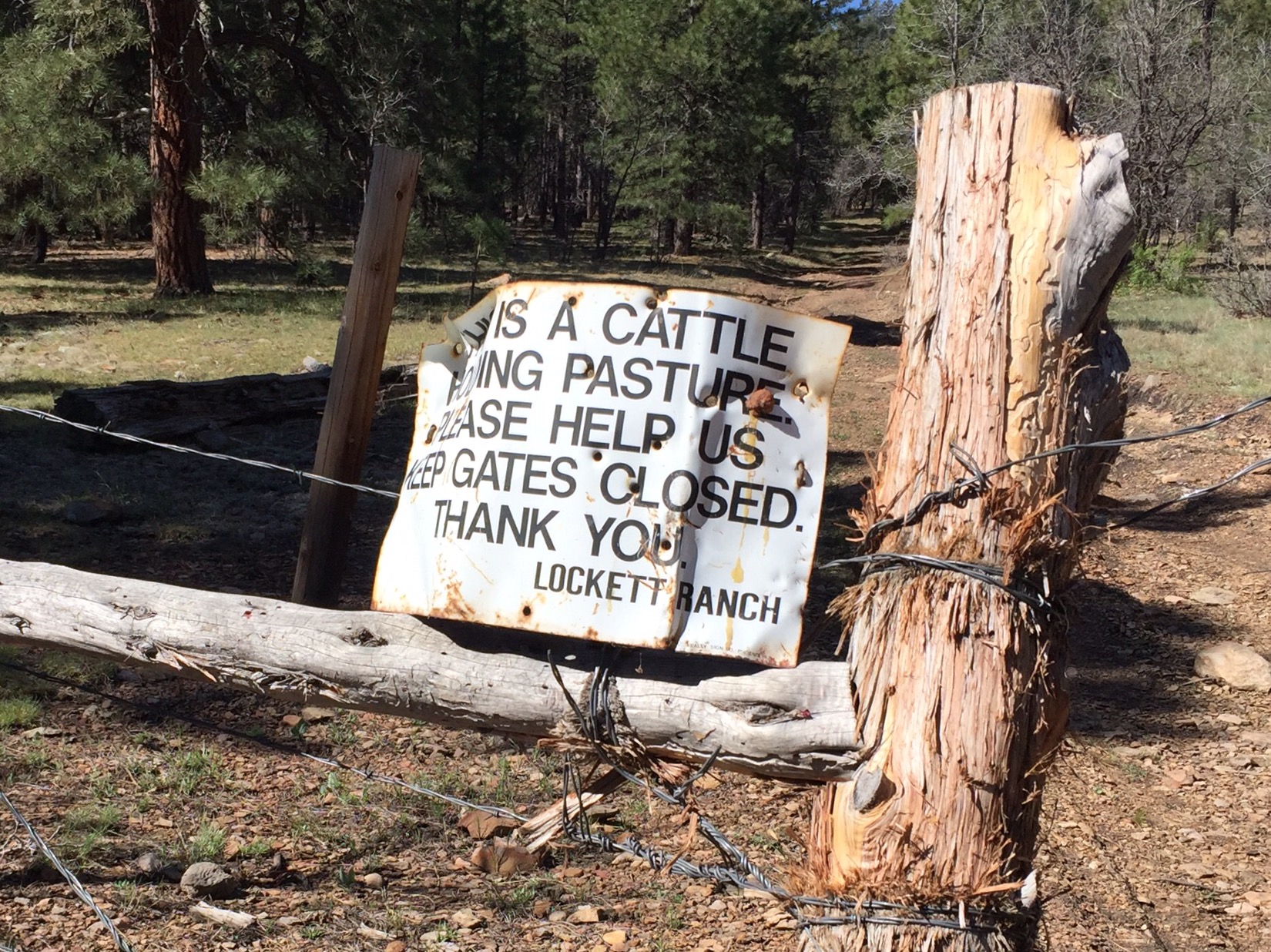
I set camp on a hill just above Mormon Lake and, with no threat of rain, sleep under the net and a dome of stars. When I wake, I feel completely present: no anxiety about timeframes or goals. I’m not sure whether it’s the book, the ease of terrain, or the rhythm of solitude. I walk easily on pine needles and think only of what’s around me. Not surprisingly, I miss a trail sign and soon I’m on the wrong forest service road. I walk ahead anyway and, as I cross a fence gate just below Mayflower Spring, a sign identifies the land as Lockett Ranch.
Below Mayflower Spring
I’m over the moon. Some goals are only reached when you stop trying to reach them. This ranch is not really in my personal history – I visited just once only 2-3 years ago – but it was carved out of the forest more than one hundred years ago by my great grandfather. My great grandparents had only two sons: one wanted to be an anthropologist (Clay Lockett) and the other a rancher (Bob Lockett). Bob inherited the lands and leases here and in Phoenix and my grandfather the land in Fort Valley above Flag. The thrill of “discovering” part of the old ranch is short but meaningful to me: a story to share and memory to add.
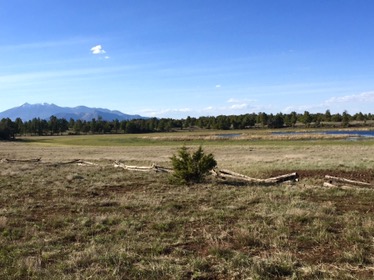
Mormon Lake (bottom) and Lake Mary (top)
As I continue north I pass what seems to be the same stuff: trees, parks, dry lakes. A biologist at Museum of Northern Arizona would see impressive diversity yet I don’t. My eye is turned inward. At peace but no desire to stay solitary for much longer. Already I look forward to the house in Flag in two days and NYC in two weeks. Some want solitude as an end in itself and some (like me) use solitude to gain peace, perspective and enrich appreciation when they return.
Peaks above Marshall Lake
I walk west of Mormon Lake, cross the highway, then walk along the mesas to the east and above Lake Mary. I find out what happened to all that snow: miles of brown mud sticks heavily to my boots. For hours it’s hard walking until I descend from the mesa to Lake Marshall. The Peaks glow above me and are my north star rising above Lake Marshall and a split rail fence as I pass it. I camp on the edge of a meadow, near fresh mountain lion tracks left on the muddy trail.
Last nights camp
I wake early the next morning before sunrise in the cold morning so I can watch the sun rise on the Peaks. Other hikers have moms who call to make sure they are ok. Maybe even daily. Sadly I’m not that lucky. My mom calls me five times a day. This morning it’s at 7am telling me which route to take (not all the way thru Walnut Canyon). I don’t tell her about the lion – that can wait.
Western reaches of Walnut Canyon
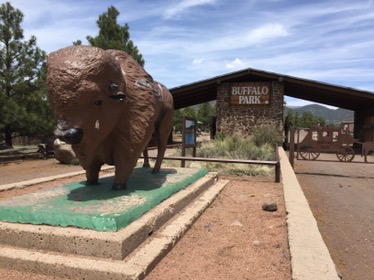
By noon I’m walking thru Flagstaff. I walk past places I know so well yet only see from cars: motels on Route 66, the huge church on Anderson Mesa we attended last Christmas, the huge expanse of Buffalo Park. It’s strange (to view all of this on foot) and wonderful. I text photos to family as I go. Old Route 66 motels in Flag
From Buffalo Park I head up to the base of Mount Elden, past the Buck Pasture where Locketts used to run sheep, up and over to Schultz Pass Road, sneak behind the collections building at the Museum of Northern Arizona, and then I’m suddenly walking up the old driveway, cinders crunching under my feet and my parents waiting for me at the door. I’m in heaven.
After a weekend with Chinita and Emma in Palo Alto, I fly back to Phoenix to resume the 34th day of my trek. Mom and Dad pick me up at the airport and we drive to Flagstaff. We drive through town, past the old Route 66 motels, then north out on Fort Valley Road to the house my grandfather built, on land his father home-steaded. We drive past the split rail fences and cross the cattle guard. I’ve been coming to this house as long as I can remember.
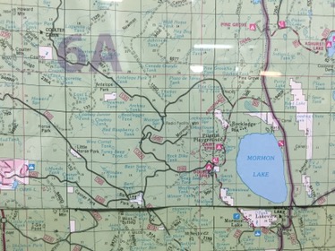
The map at the ranger station: Lockett Ranch is near Coulter Cabin in top left
In the morning Dad drives me 90m down to the Mogollon Rim ranger station where I will resume hiking. We drive south past Lake Mary and Mormon Lake. I’ll walk past this country in the other direction in a few days. When I get to Mormon Lake I’ll look for signs of Lockett Ranch. Both lakes and the land around them are now covered in snow. This will be a problem if it doesn’t melt. Dad drops me at the trailhead and I start hiking again at mile 500 of the AZT.
Dad drops me near mile 500
The day is nice. I walk mostly in dry weather with only the occasional rain but I’m surrounded by swirling boiling clouds of black, white and gray. The trail follows forest roads without snow but they are muddy. I see another thru hiker I first saw weeks ago outside of Oracle. For 3 hours David and I walk together. He was a Navy corpsman in the Gulf War and now walks as part of a veterans project. He saw good times and bad times he says. He is a good companion and the time flies.
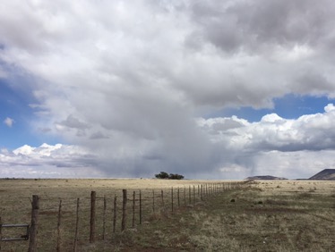
Storms coming tonight
In the afternoon David needs to stop and I walk alone. I listen to the Snow Leopard on my iPhone. I love the images in Mathiessen’s book about Tibet, love his attention to the small things, the waterfalls falling in the mist, the zen of solitude and quest. What most strikes me is the letter from his eight year old son asking him to come home. I’m struck by the beauty of the letter, but I also think of the selfishness of a man who treks for months at a time. The parallels to me are clear. Yet Clay wouldn’t write me such a letter. His is beyond that stage. He is a young man. It’s hard to get him to talk when I call home. His love is clear but I think he is setting his personal course in life and I admire him.
Water bags froze last night
That night I hear rain on my tent but I’m warm and dry. The next morning sunshine. The first sounds are wild turkeys just before dawn, then the loud staccato of woodpeckers echoing. There is ice coating the water bladders outside the tent. The clouds from last night are gone, having emptied themselves on the forest around me. The sun glistens off beads of water hanging from the barbed wire fence and a fine mist rises from the meadow. It’s still too cold to get out of my tent so I sit half in my bag drinking coffee waiting for the sun to climb a bit more before I brave getting dressed and on the trail.
Tanks along the way
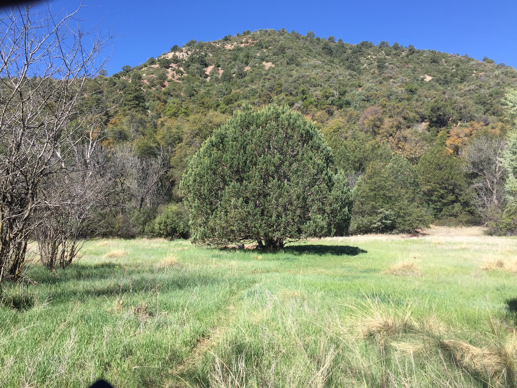
Many times the trail follows forest roads and then veers off and I miss the sign. When I realize the mistake I don’t backtrack, I blaze my own path and rejoin the trail a mile or two miles later. I have family history near here if I can find it. I walk past hunting camps, meadows and stock tanks with grass greener than I have ever seen. Tomorrow I will be just north of Mormon Lake and close to Coulter Cabin and Lockett Ranch, but most likely too far to actually see it.
One of many gates along the AZT
By afternoon I run into David again. We talk as we hike. He says he was raised a Catholic but stopped after he came home. He says he looked at the people around him and thought they had nothing in common. He wondered what kind of God would allow the things he saw.
Finally I’m within hiking distance of the Rim. Tomorrow will be my 33rd day of hiking, and my Uncle Henry has called to say that he’ll make the 90 minute drive from Sedona at the end of the day, pick me up at the ranger station, then drive me to Phoenix after I spend the night at my Aunt Beverly’s house. I need to cover 35 miles and climb the Rim to meet him by tomorrow afternoon. Cake.
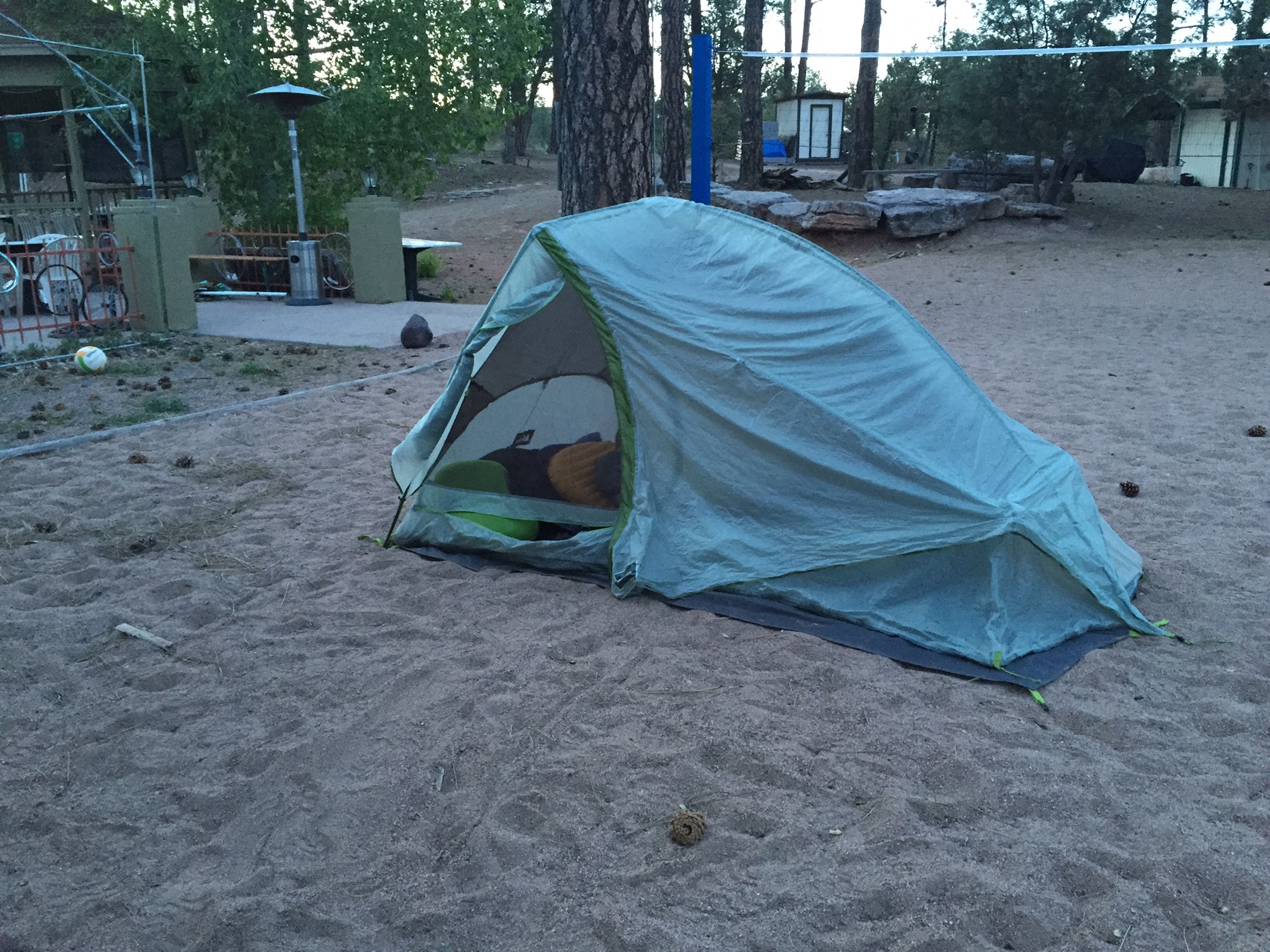
The volleyball court in Pine
I start the day waking up on a volleyball court. The brewery/motel that had so graciously taken my email reservation (and credit card) a few days prior was deserted last night, so after a few calls I gave up and camped outside their beer patio. After waking, and pancakes at The Early Bird restaurant in Pine, I head off for the final push.
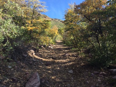
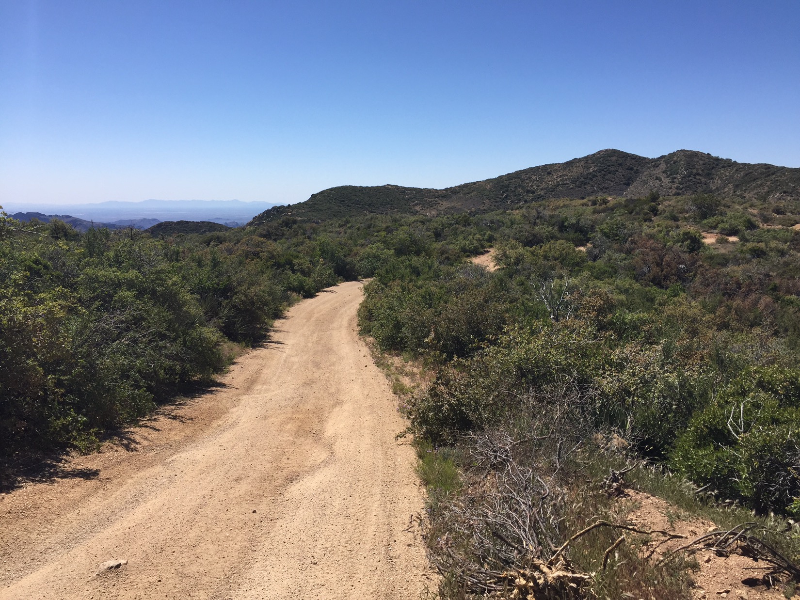
The passage along and over the Rim
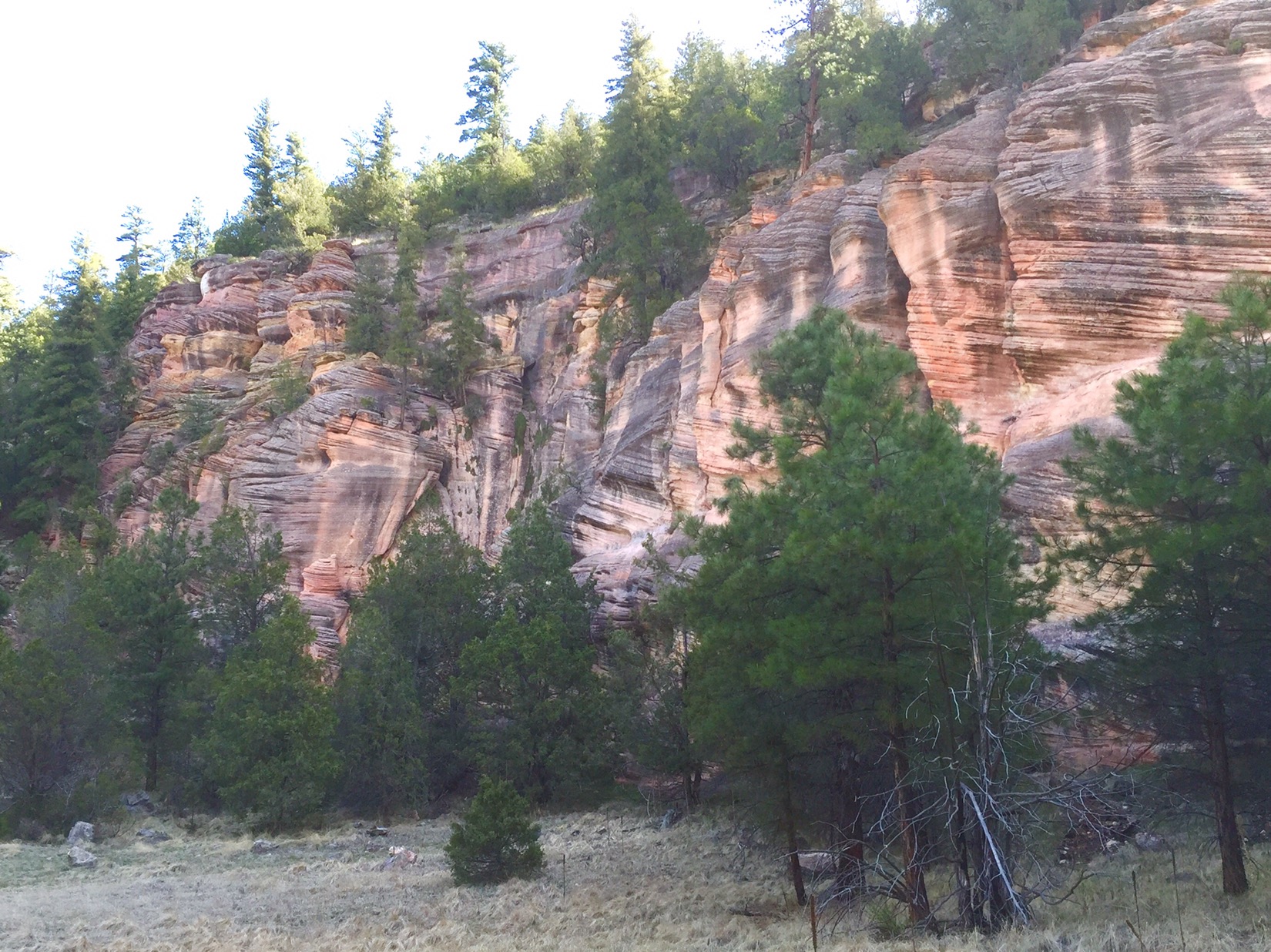
The Mogollon Rim itself is officially an escarpment (had to google that one) that runs 200 miles across the state of Arizona. It’s named after Don Juan Ignacio Flores Mogollón, the Governor of New Mexico from 1712 to 1715. Arizona was once part of the territory of New Mexico, so I guess that’s why a dude in Santa Fe got dibs on an Arizona landmark. Most people see it around Sedona, where erosion creates spectacular red rocks. East of Sedona it varies between cliffs and steep slopes until it peters out near the border with New Mexico.
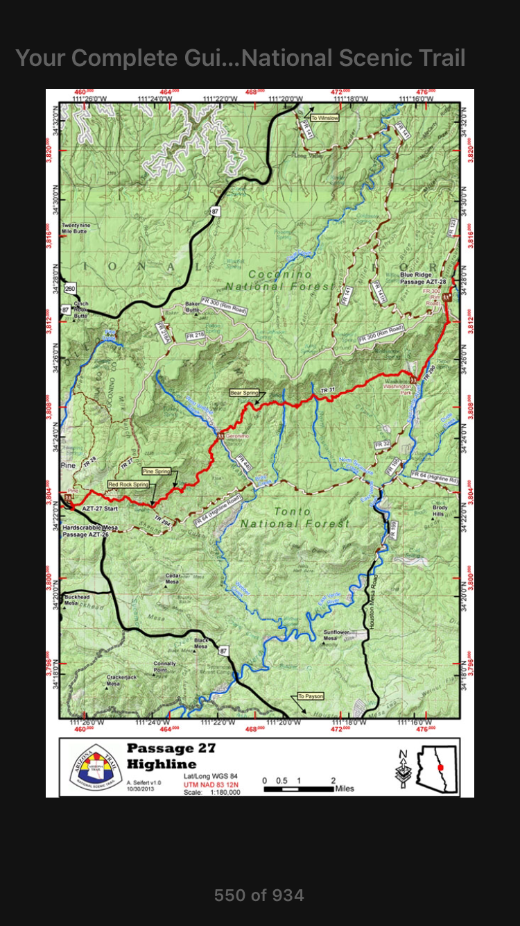
The High Line Trail (and Rim above)
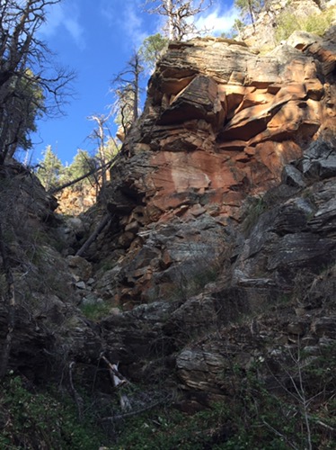
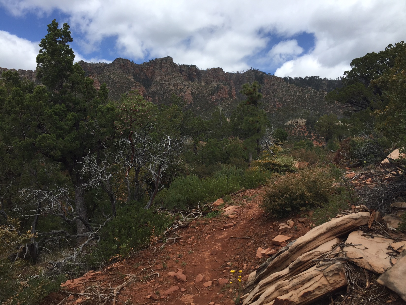
For about 10 miles, I hike along the historic High Line trail just below the Rim. I get glimpses of the occasional cliff through the trees and cross cold and clear streams. I run into various hikers, including Chow Mane, but I press ahead to get above the rim before it gets dark. Late in the afternoon I climb a steep trail next to a rushing stream that is a source for the East Verde River. At one point I follow the wrong rock cairnes and emerge on a rocky ledge beside an abandoned RR tunnel and cabin. It’s a bit scary because if you take the wrong trail, you can get in rough terrain very fast (as it gets dark).
Railroad tunnel and cabin just below the Rim
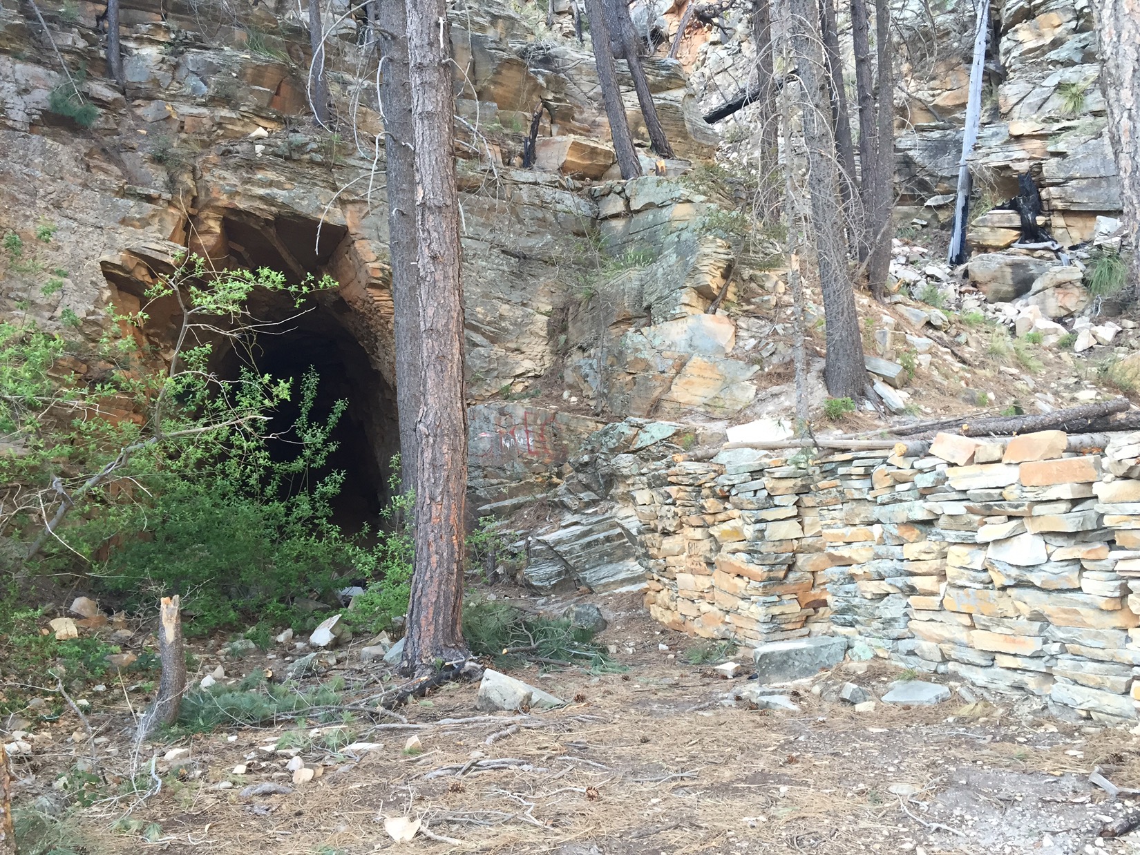
By 6 I’m above the rim and walking through General Springs Canyon, named after the general who fought and ultimately captured Geronimo . There is a monument to an Apache battle near the trail, but the forest is quiet and a beautiful place to camp. The next morning I rise early to make my appointment with my uncle. I’m caught mid-morning by one of the hikers I passed the day before. He says that he and Chow Mane got lost climbing the Rim as the sun set, and that Chow Mane turned around and went back to Pine.
Camp in General Springs Canyon
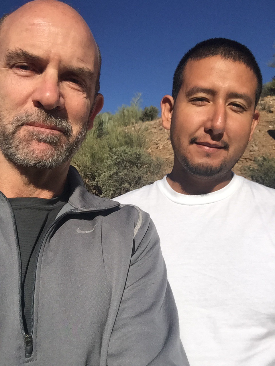
I reach the Mogollon ranger station by mid afternoon. To pass the time I wander inside and ask the rangers if they know where Lockett Ranch is. We’re still searching maps when Mr. Henry Lockett himself arrives to pick me up. He points out the ranch on the map. It’s near Coulter Cabin, about two miles from where the trail will pass in a few days. As he drives me to Sedona, past Happy Jack, past Stoneman Lake and down I-17, we talk about his visits to the ranch when he was a kid, about Lockett history and about everything in between. I couldn’t be happier. I’m safe, I’m with family, and I see Chinita and Emma tomorrow.
The miles after the Mazatzals are notable for how much easier they are, and for my gradual return to civilization. Sometimes civilization can be nice, but sometimes it can get weird. Spring above LF Ranch
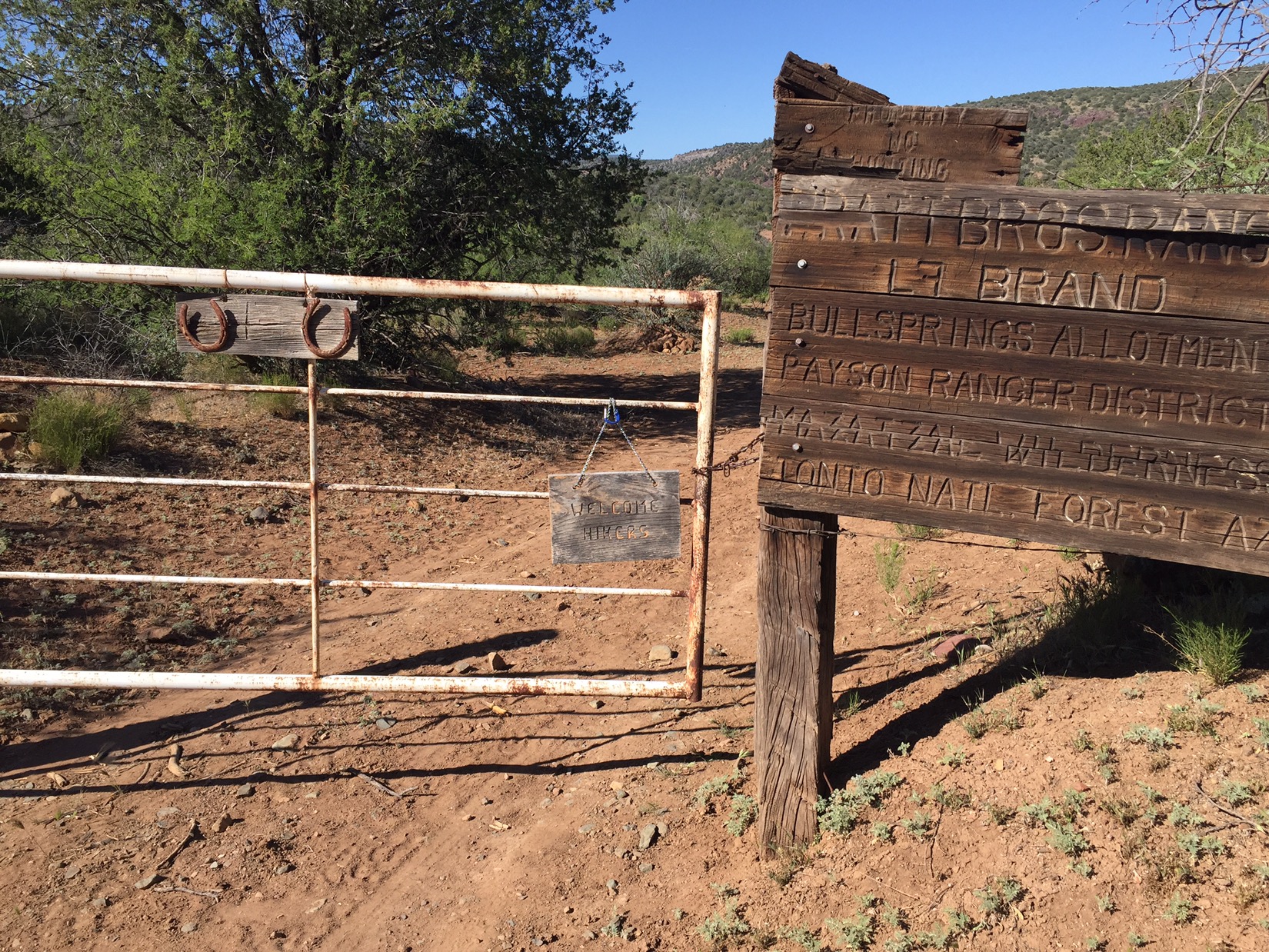
By the afternoon of the 24th I’m getting hungry. Nothing urgent, but I’ve lived for seven straight days on water, beef jerky and freeze dried dinners. I won’t get a hot meal until the town of Pine the next night, so I make a pit stop at the LF Ranch on the banks of the East Verde River. Other hikers have said the ranch has free water and electricity for AZT hikers, and serves dinner for $15 if you’d like it.
Gate of LF Ranch
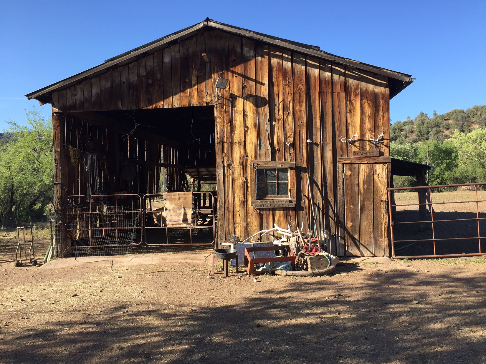
I walk up the road to the ranch as the shadows start to lengthen in the late afternoon. There’s an old house with chickens and dogs on one side of the road, a small bunkhouse on the other, and a barn in the middle. I can’t see a soul at first, but soon I notice four hikers sitting on a couch on the porch of the bunkhouse. They look forlorn, like souls waiting in Dante’s Purgatorio. None want to be there, but they all paid the $15 for dinner and are waiting for two hours until it’s served. Turns out the friendliest one is Chow Mane, the hiker who met my dad in Lake Roosevelt. We have a great time chatting about his home state (Massachusetts) and the Pacific Crest Trail (he hiked that one just before the AZT), but soon he gives up and gets back on the trail.
Barn at LF Ranch
There’s no way I’m waiting around. In addition to the lonely hikers, there’s a guy named Shawn who stomps around feeding the cattle, barking instructions, and perfectly fitting the definition of an ornery ranch hand. I knock sheepishly at the door and ask if I can pay anything to get any food the owner, MaryAnne, has in the kitchen. MaryAnne says sure and makes me two of the best tuna fish sandwiches I have ever had. She is the reason hikers love the place. I wolf down the food, give hurried “good lucks” to the three remaining hikers and continue north. They look sadder than ever.
East Verde River
That night and the whole of the next day I gradually gain both elevation and miles. I cross the pretty eastern fork of the Verde River, then walk the red dirt roads and meadows of Hardscrabble Mesa. The trail is nice, the pace is fast, and by early afternoon I’m deep in the pine forest below the cliffs of the Mogollon Rim. I’ve earned a break and a bed.
Forest near Pine, Arizona
I walk up highway 87 and into Pine with enough time to wash clothes, buy supplies and have a couple of beers and a burger at Sidewinders Saloon. Game seven of the Black Hawks/Blues game is on one of the TVs inside and the place is jumping. By nightfall I’m talking hockey and hiking with a bunch of locals at the bar. We are all perfectly happy being just where we are.
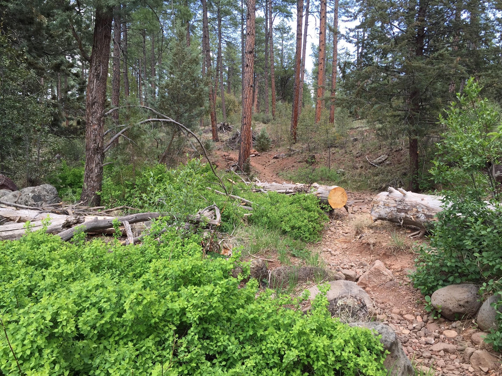
These are the 28th and 29th days on the trail, and this is the last range before rim country. It is by far the hardest. I try to find something inspiring in every section of this trail (and there are cool places in this passage), but for the most part this is the passage all AZT hikers complain about. It’s got the steep ascents and descents of the supers and four peaks, but lacks the long, ambling stretch of dirt road on top. What’s worse, the Mazatzals have been savaged by forest fires, and the trail is choked with with brush that grabs at my pack and clothing.
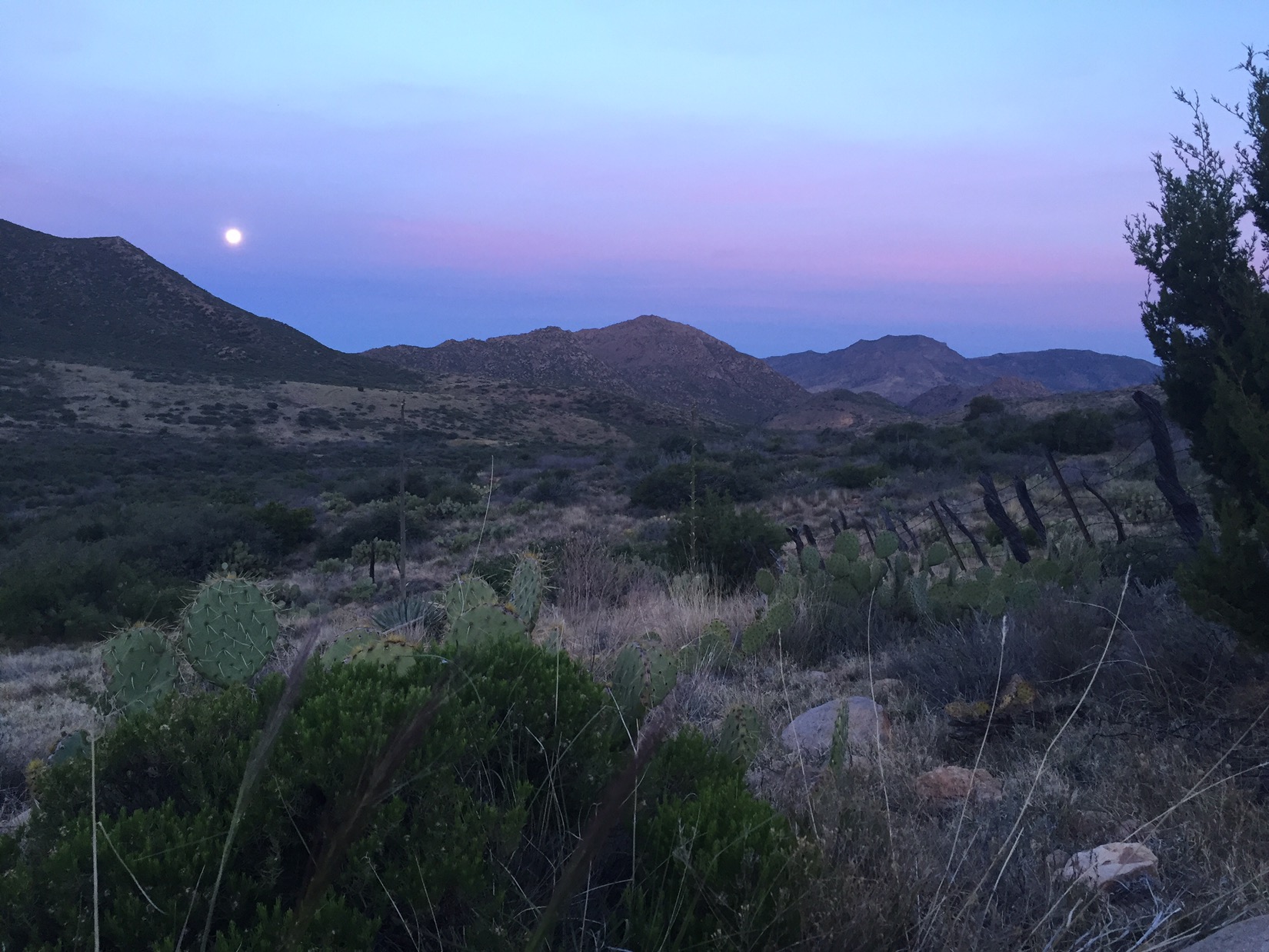
Moon before sunrise
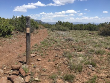
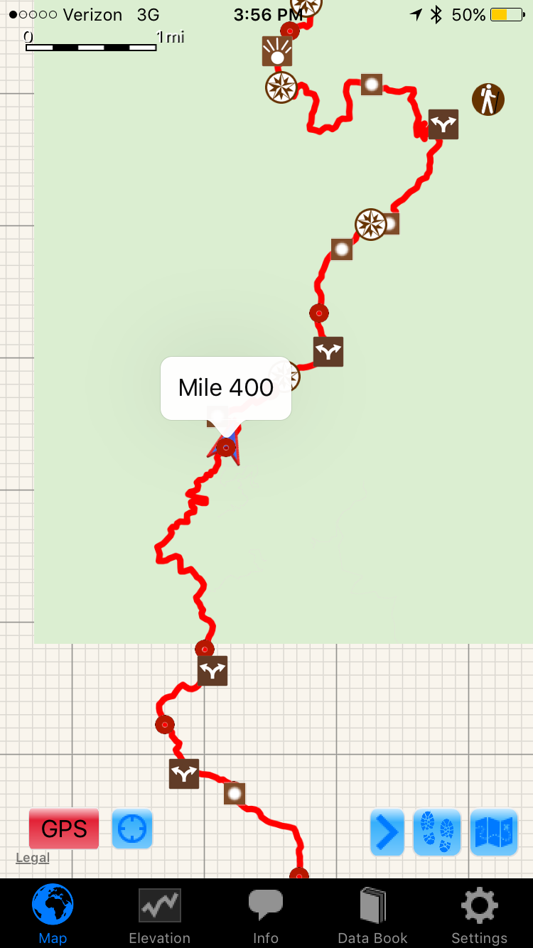
Knowing I’m in for a tough couple of days, I start early. That moon from last night is still in the sky just before sunrise, and it glows softly just to the west over the corral. The first miles of the morning take me under the Beeline Highway, and slowly up the southern slopes of the Mazatzals. I don’t realize it at the moment, but by the time I hit mile 400 I’ve seen the last of the Sonoran desert (and completed half of the Arizona Trail). I’ve given up using topo maps, and am mostly navigating with a Guthook app on my iPhone that shows notes on water sources, key landmarks, and my position on the trail.
Halfway
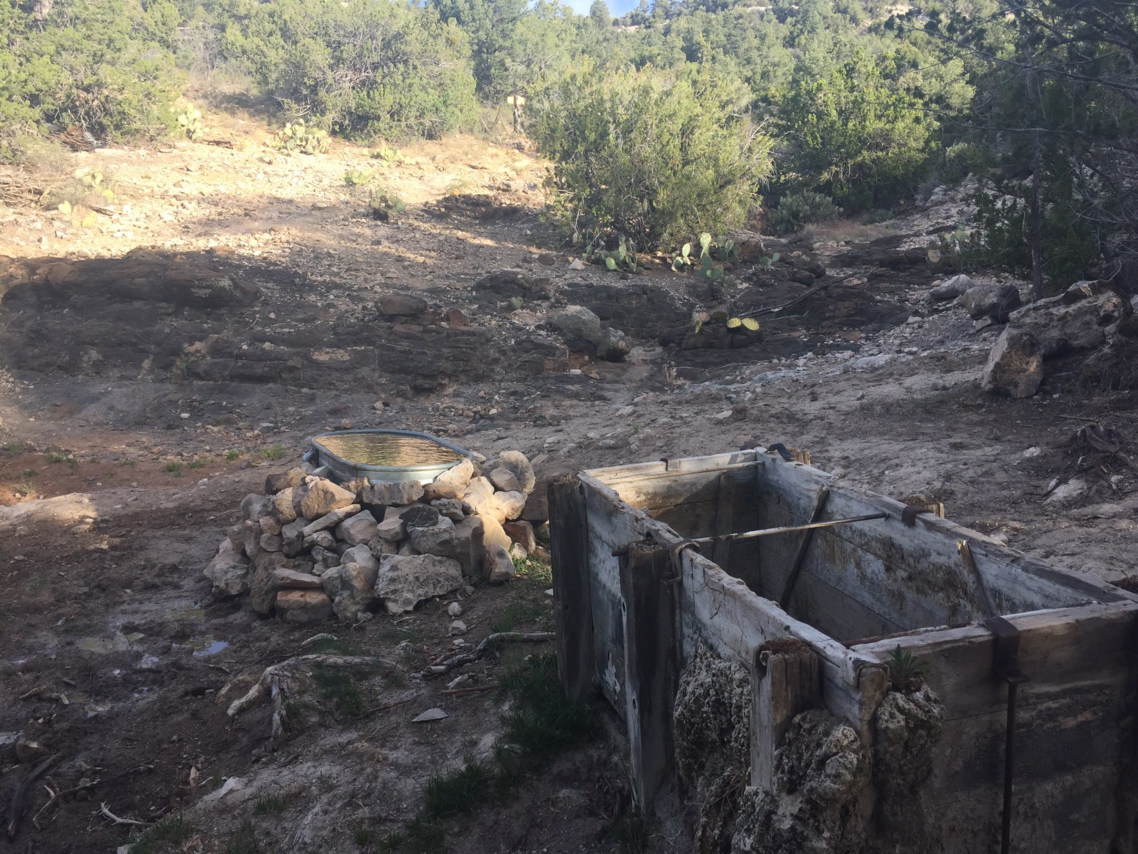
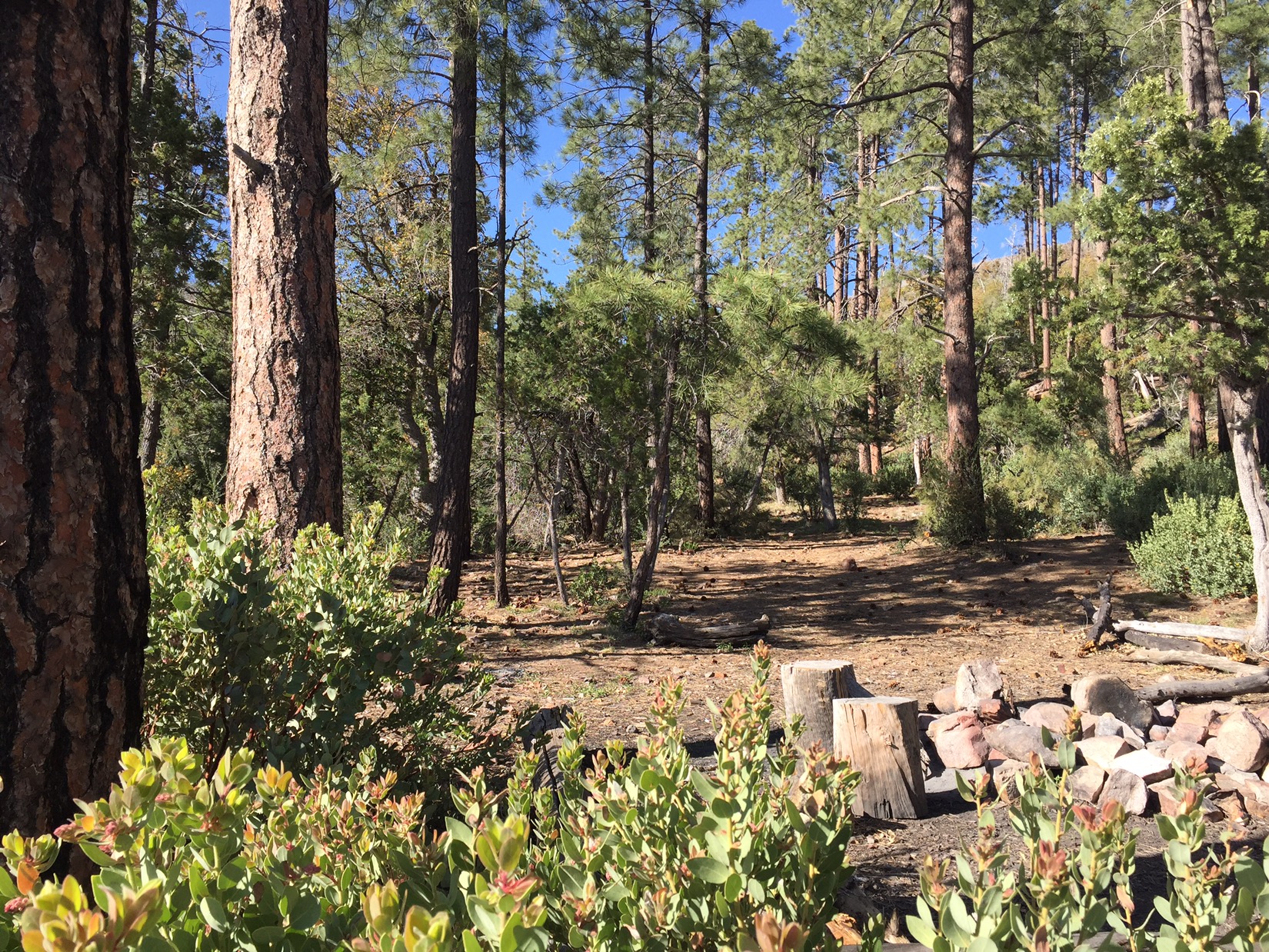
Although the days are mostly hot sun and manzanita, there are moments of deep shade and beauty. When the trail dives into deep canyons that the fires couldn’t reach, I pass through stands of tall pine trees. Many of these canyons have small springs called seeps where water trickles out from the slopes and crosses the trail. My favorite of these is Horse Camp Seep, not only because of the pools of sweet water on the slick red rock, but the images the name evokes of cowboys finding their way to this camp without an app or GPS. I might need to man up a bit.
Horse Camp Seep
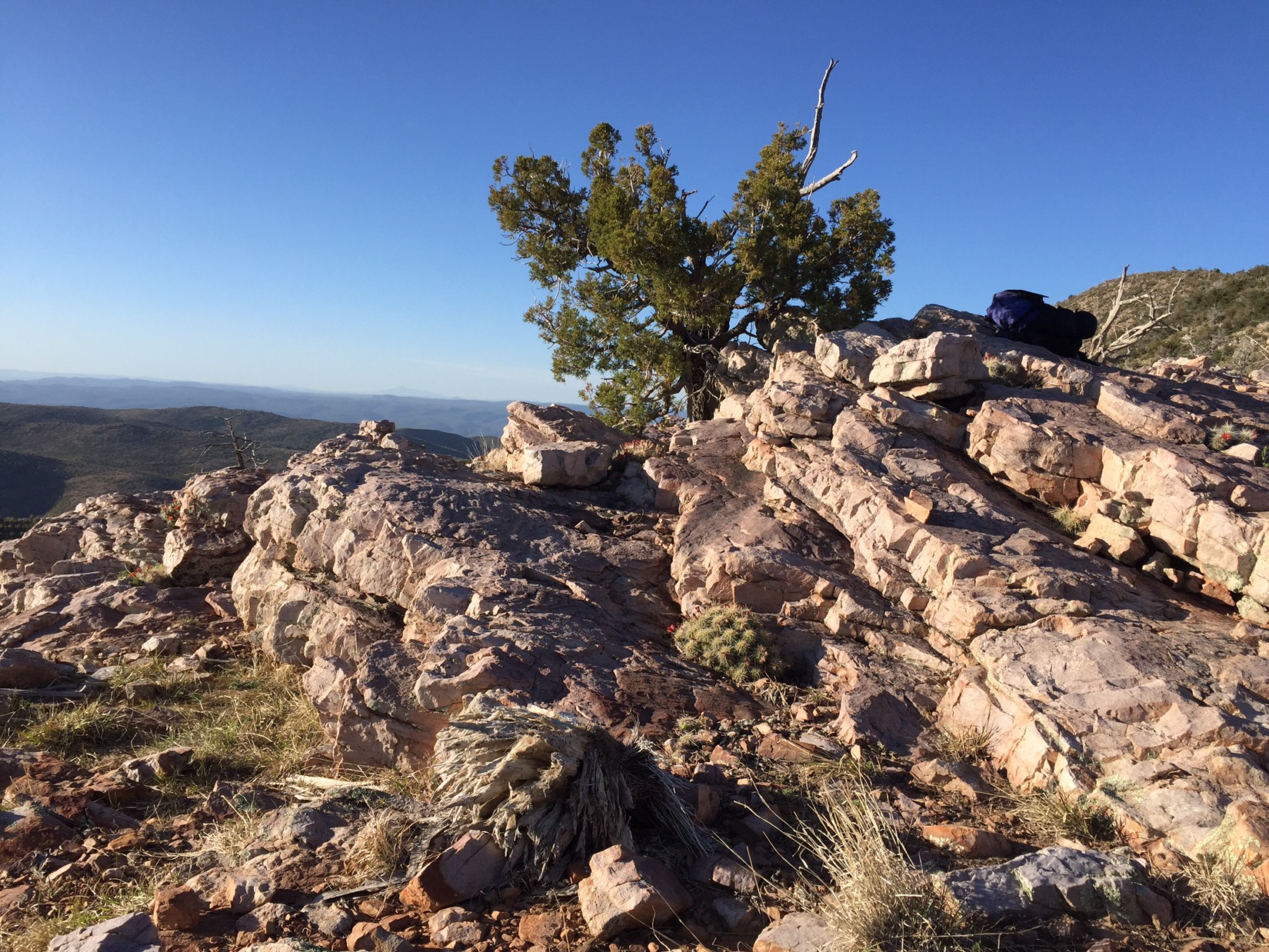
By the second night I’ve reached the end of the range. I camp just 100 yards below a rocky ridge that opens up dramatic views of the Mogollon Rim to the north and beyond. Family history on my mothers side is concentrated in that country. Soon the trail will pass by ranches, cabins and canyons that I’ve always heard spoken about but rarely if ever put in any kind of context.
Entering north country
As the sun sets it gets chilly for the first time in weeks. The last light shines on the ridge, and I can barely make out the San Francisco Peaks above the dark green line of The Mogollon Rim. They are white with snow from a storm that passed trough Flagstaff just one or two days before. It’s hard to believe I’m seeing them (Google maps assure me that’s them) after all this time in the desert. The Peaks represent a bit of a spiritual goal of this trip, but I have more than a hundred miles of hiking to do before I reach them.
After camping next to Lake Roosevelt for the night, then picking my battery up at the visitors center in the morning, I tackle the next passage of the AZT. I want to ratchet up the mileage until I reach the Mogollon ranger station in 8 days. From there I’ll catch a ride to Phoenix and fly to Palo Alto to meet Chinita and Emma. Then back to Phoenix on May 1 and back to the trail to finish. Sounds easy huh? The goal now is as many miles as possible without breaking anything. I want to see if I paid a price for yesterday’s 20+ mile race through the Superstitions.
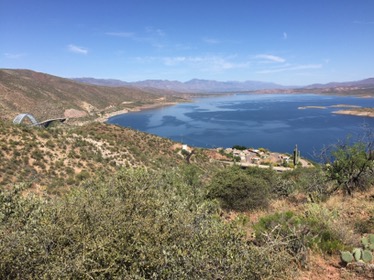
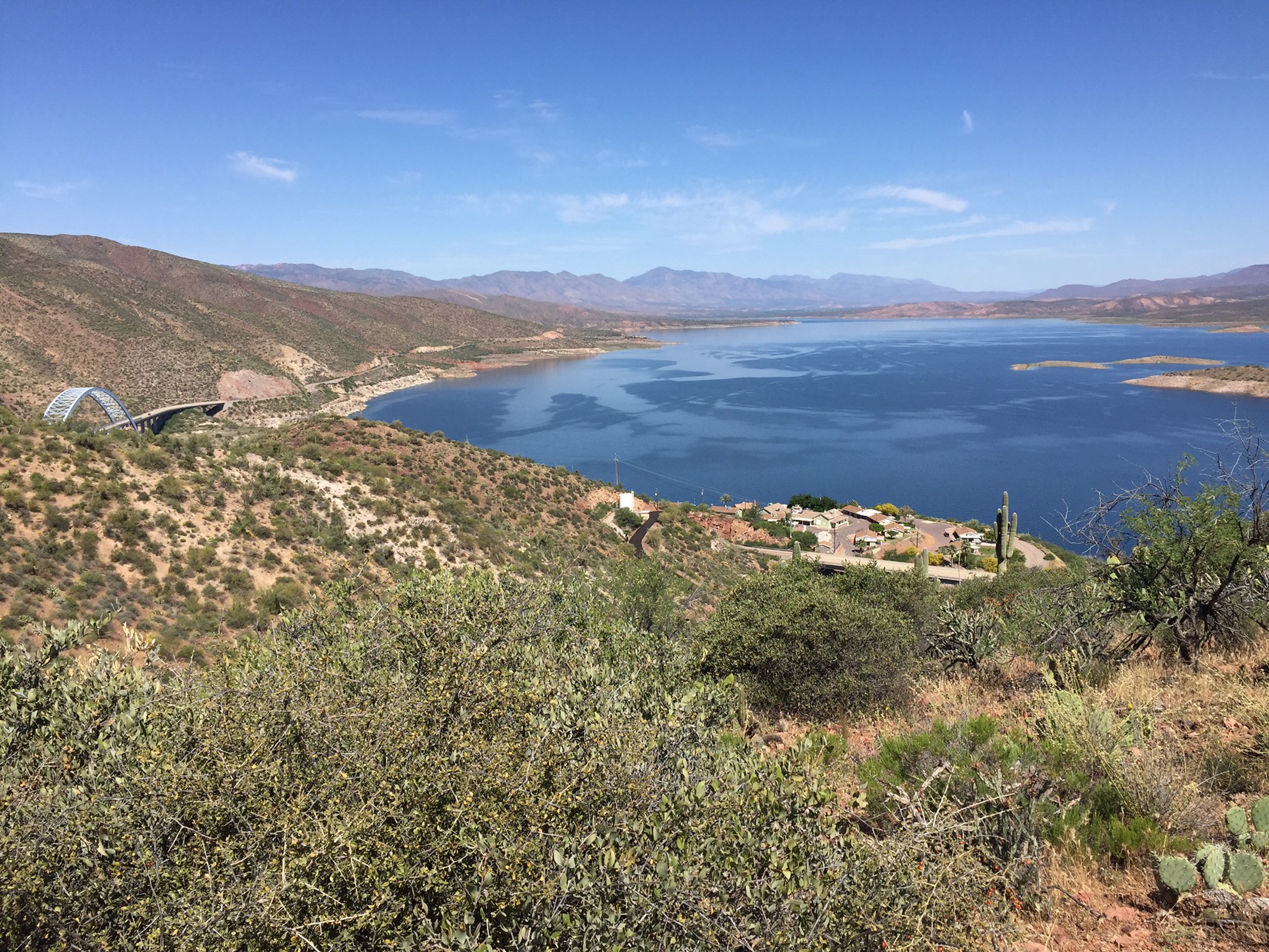
Heading for the bridge by Lake RooseveltI paid a price. By 2pm on April 20, I’m dogging it. Not even 10 miles into the day. The climbs are a bitch. The Four Peaks Wilderness is one of two remaining mountain ranges between me and the Mogollon Rim to the north, and the first 10 miles climb 3100 feet. It’s hot, it’s hard, and the whole mountain range has suffered from forest fires that have left miles of manzanita as the only vegetation. That night I sleep in a saddle amongst a thicket of manzanita. They are all blooming, and the sound of the bees is constant. They stop buzzing only when the sun sets.
The flowering manzanita (and bees)At sunrise the bees resume buzzing and I, after coffee, resume hiking. The top of the Four Peaks on this day is a much better story. I’m on top of the world. I hike 22 miles on a soft dirt road that twists and turns. I get amazing views of the desert far, far below, and I get the shade of boulders, pinyon and the occasional ponderosa pine. I run into two guys lost in the mountains in a side by side. They ask me for directions…
On top of four peaksWhen I finally descend from the Four Peaks, I spend the night in an abandoned corral at mile 382.6. Tomorrow I tackle the Mazatzals, but tonight I can take it easy. After dinner, the moon rises over the mountain slope in the southeastern sky so brightly it’s as if someone suddenly switched on a giant porch light.
The manager of the (now notorious) Copper Mountain Motel says his friend can give me a ride back to trailhead. Valente meets me and another hiker just after sunrise. As we drive west, drinking coffee from Circle K, I tell him Superior is a nice town and he shrugs. His dad used to work in the mine and he bets the mine will grow when the owners work out a land swap with the apaches. Until then there’s not much work and it’s easy to get into trouble he says. After we drop the hiker off, he takes me 4 miles further and talks about wanting to stay in his daughters life, and how he’d like to go back to school to become a mechanic. I like him.
Valente drops me off
After I leave Valente I head up Reavis Canyon into the Superstitions. The Superstitions are legendary mountains in Arizona. We went on trips there as kids in Indian Guides (kind of like Boy Scouts). We heard stories of the Lost Dutchman, who rode into Phoenix one day in the 1880’s with gold to buy supplies, and then went back to the Superstitions to work his claim but was never seen again. I now hike in the far eastern part of that wilderness. The trail follows the stream bed for a few miles, past corrals and stock ponds – some new some abandoned. It’s rugged but amazing.
Stone corral in Superstitions
By early afternoon I climb out of the canyon. When I get up top the trail merges with a sandy road twisting and curving with short bushes and shrubs on either side and a steep drop off to the west that makes it feels like a road by the coast. There is a great basin up here with pinyon and juniper and manzanita. I’d like to come come back here with my family. I had no idea this was here.
Like a coastal highway
Eventually the trail goes off the top into another canyon, and that night I camp at Revis Saddle. On top of Revis Saddle and beyond is another different world. I walk through broad green meadows with old trees that used to be farmed by the Revis family over a century ago. Revis used to supply produce to all the mining communities, but now the farmhouse has crumbled and the forest has reclaimed the land. It’s amazing that as a kid I only thought of the hot, dramatic desert walls of the western Superstitions but never even dreamed the eastern part existed.
Revis canyon
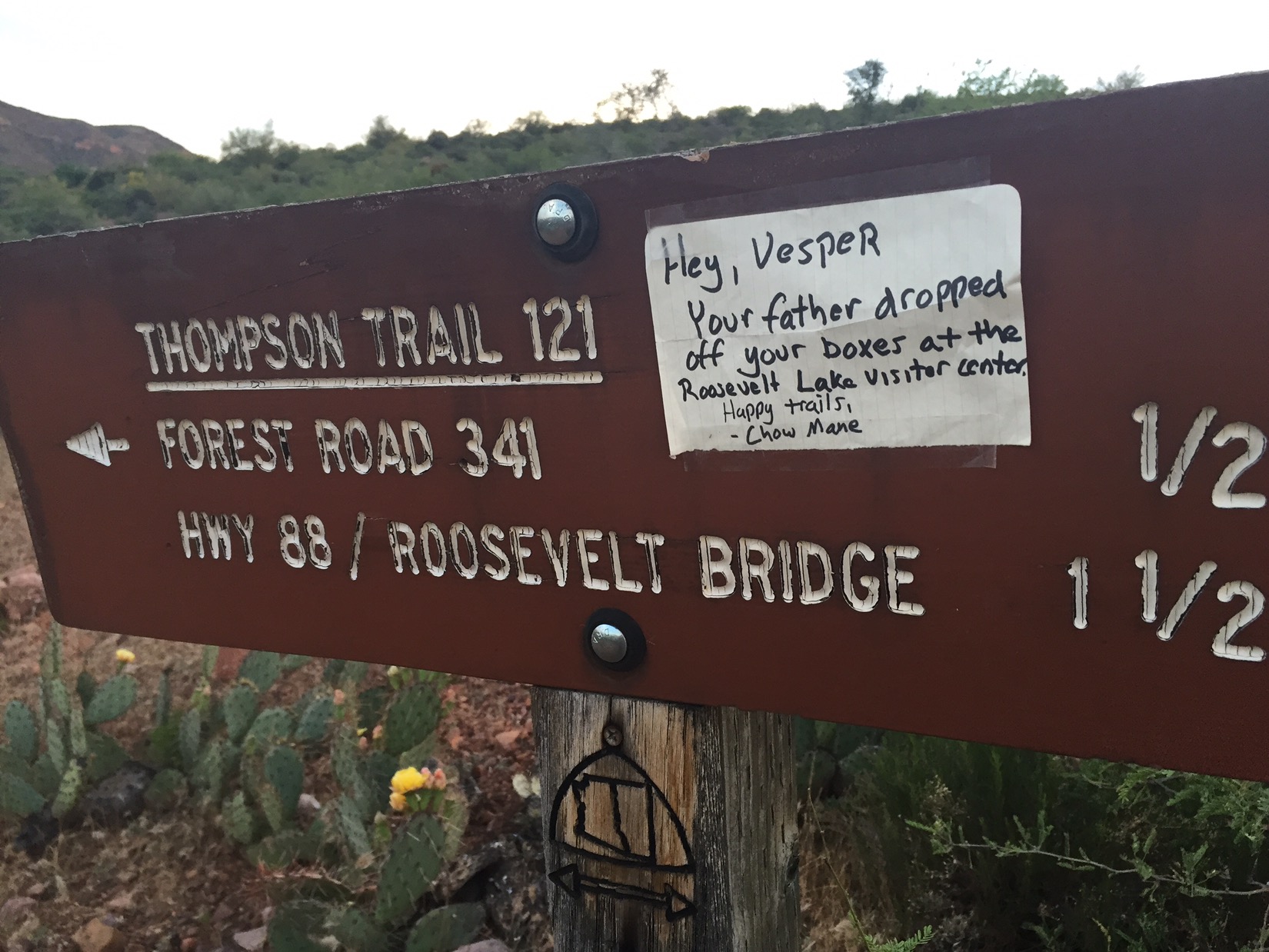
After I get off Revis Saddle it is a race to the end of this part of the trail down at Lake Roosevelt. The battery I use to recharge my phone has quit on me for some reason, and I ask my dad to mail my spare to the visitor center at Roosevelt Lake. He decides to drive it there just to leave nothing to chance. My dad. While I race the 20 miles down the remainder of the trail so I can make camp at Roosevelt Lake by dark, he drives the two hours to get the package to the visitor center before it closes so I can get it first thing in the morning. When he gets close he gives a ride to an Arizona Trail hiker who is hitchhiking to the lake. His trail name is Chow Mane and they have a good talk. When I finally make it to Lake Roosevelt just before sundown that night, I’m too late to see Dad (he left hours before to make it back to Tucson), but I know exactly where to get the package the next morning. Thanks Chow Mane.


