March 9: Kentucky Camp

Day 8: A house is not a home

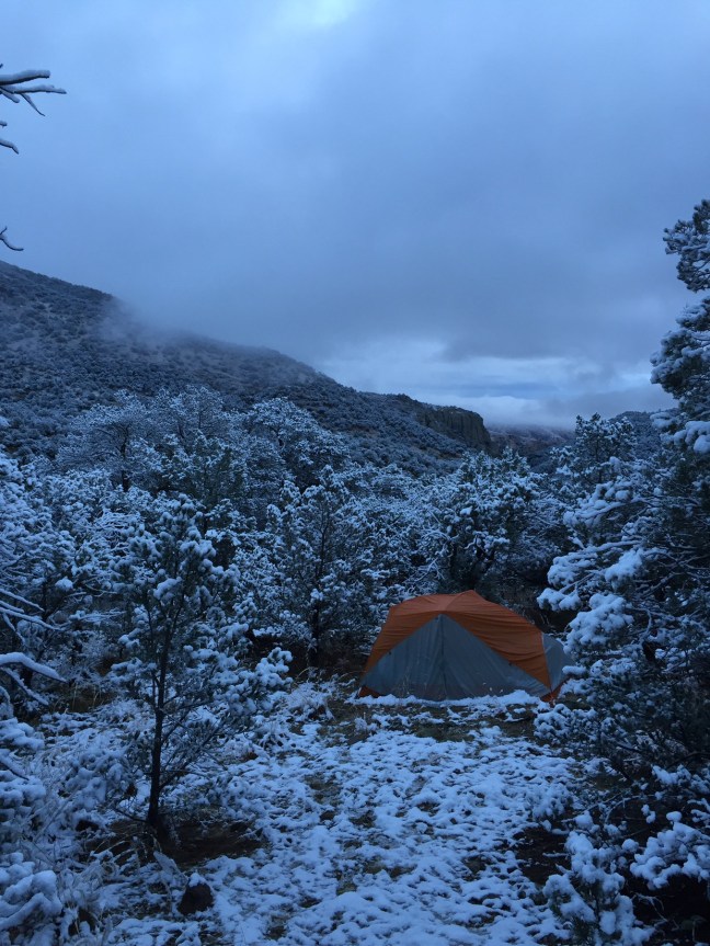
The night before was a little depressing. The cabin was fine – clean, dry but cold – but I felt more alone inside than I had come close to feeling on the trail. Something about being inside a well lighted place looking out on the dark makes a hiker feel cut off. Being in a cabin also suddenly made me miss my family more – no one to share it with. It didn’t help that I also couldn’t talk to my wife thanks to bad cell phone coverage: after an hour of holding the phone above my head on a hill above the camp in the gathering darkness we had given up. Frustrating.

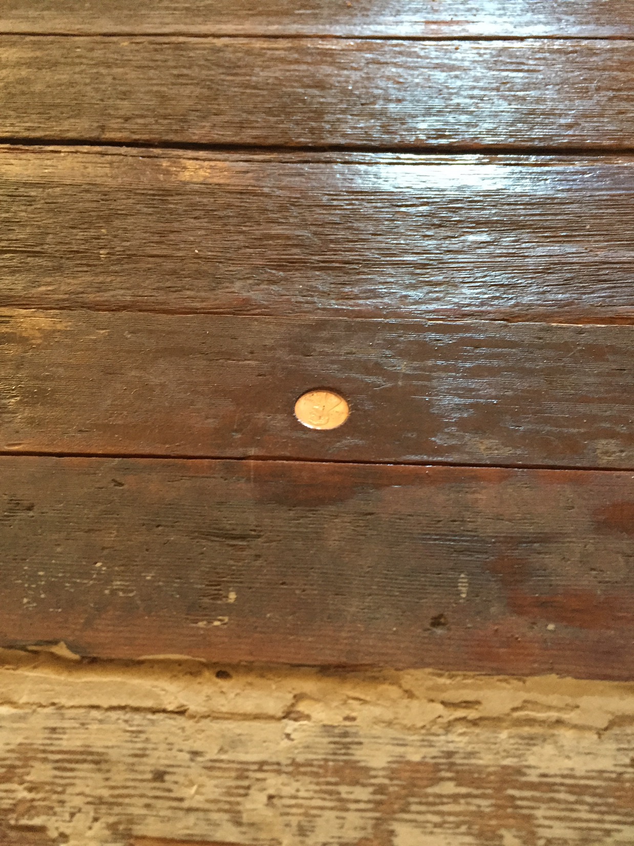
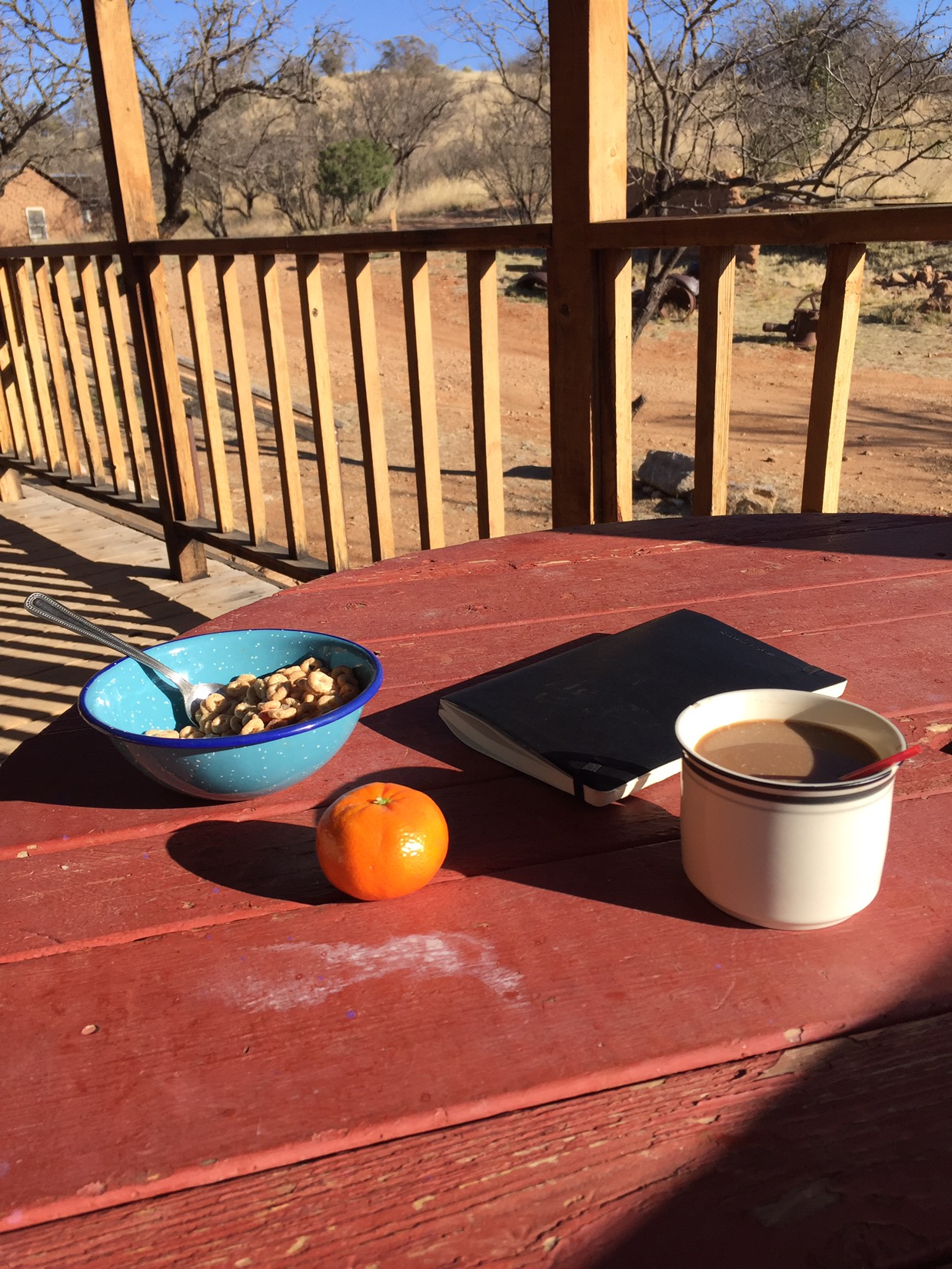
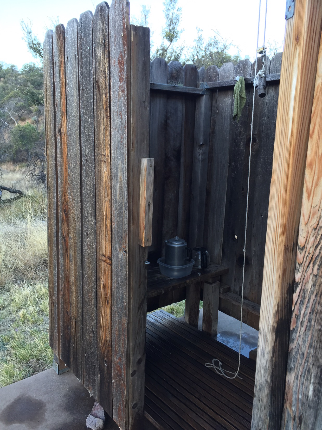
 The next morning was different. The day was warm and sky clear. The sun streamed into the cabin. I heated water on the old hot plate in the kitchen and showered (i.e. poured it over my head). outside behind the outhouse. I had coffee and breakfast, sketched on the porch. Noticed all the quirks of the cabin – down to the penny embedded in the floor boards under the threshold to the bunk room.

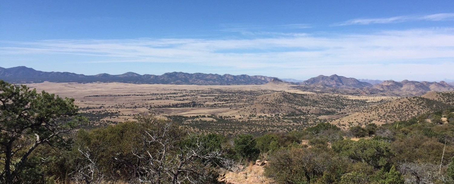
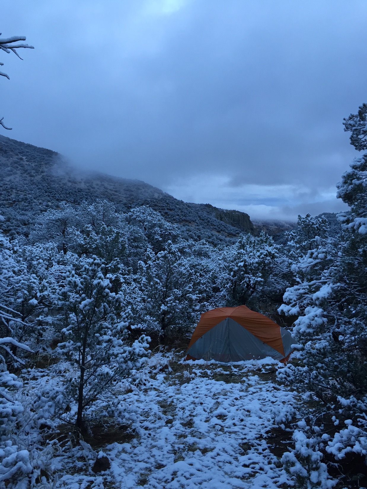
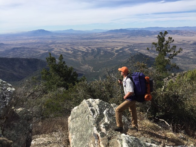
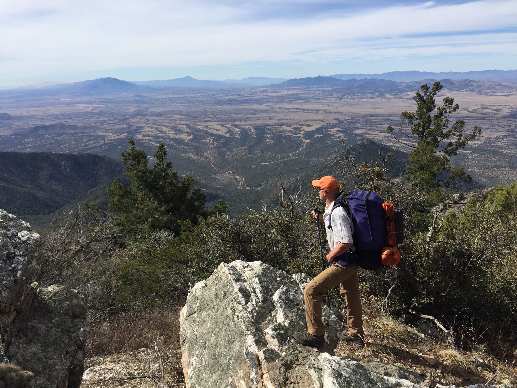
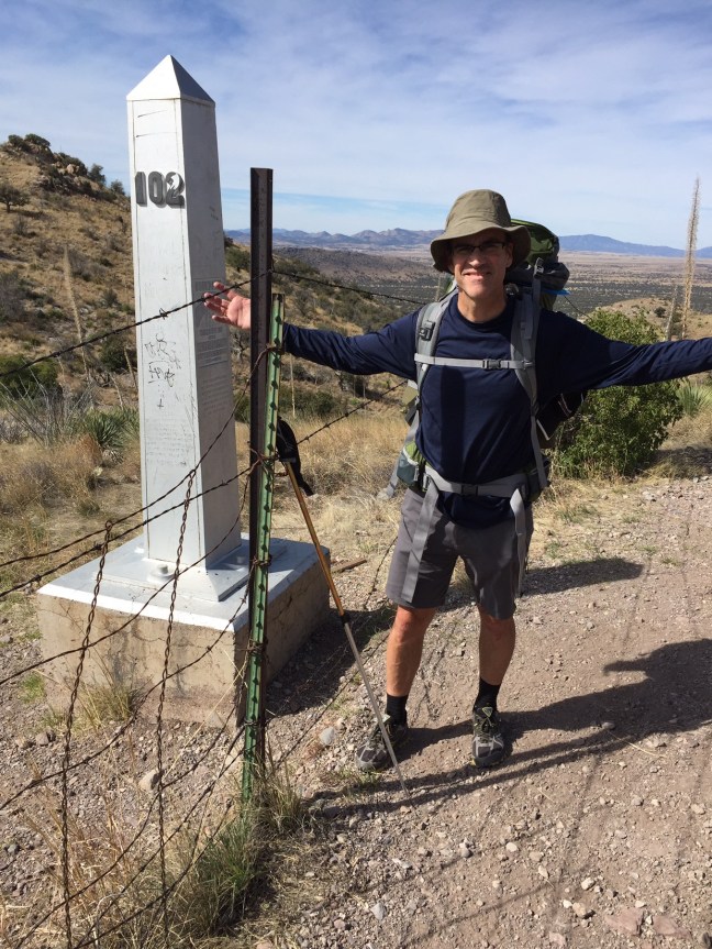
 The hike out of Kentucky Camp was a blast. Within the first mile I passed three coyotes that scattered from the trail, every hour or two a covey of quail would break before me. I passed the 100 miles from Mexico mark sometime that day and was making good time. I passed other thru hikers (what they call people hiking the whole 800 mile trail) a few times during the day: Adrian from Prescott who wants to be a forest ranger; Pete, Esther and Judy from Alaska who laughed that the water doesn’t need filtering up there. Sometimes I walk a few miles with these folks, sometimes just take a few minutes to trade stories. Always a common bond, everyone content to be living in whatever moment is happening right now.

March 8: Santa Ritas

Day 7: Snow

I wasn’t surprised that the rain had turned to snow, but I didn’t expect the colors.

 I opened the tent flap to see snow all around me. Great gobs of white on top of the rust red of the rocks and grey green of the juniper and pine. The clouds were thick and gray in the canyon below me, but with hints of white, pink and yellow where the sun was starting to peak through. I was warm and happy with coffee, cereal and the tangerines Mom had brought me the day before.

Everything was dusted with a confectioners sprinkle of snow. Only the trail itself stayed warm and dry. After two hours of hiking in a gradually warming morning, the first drop of melting snow hit the trail in front of me. The drops turned to clumps that fell from the trees, and soon the forest around me filled with the sound of falling water. By the time I got to Bear Spring, the creek was running higher than anything I had seen.

 I made great time – hiking downhill helped. Soon I was zooming along through mining country and grasslands at 5000 feet. No hikers, but saw more Border Patrol than I’d ever seen before. Some hikers had spotted 10 refugees on the trail the night before, and the agents were trying to track them down. I saw or heard at least a half dozen Border Patrol SUV’s searching. Finally a BP helicopter flew about 500 feet over my head and hovered over the rim of one of the canyons.

 The final miles were easy: through rolling hills, grassland and mining country. Today it was beautiful. A hundred years earlier the countryside was covered with mines. They used hydraulic mining – blasting hillsides with pressurized water and sifting the resulting detritus for gold and silver. The rusted pipes, mine entrances and dams were still there.

At 4pm, sun still in the sky but low, I walked into Kentucky Camp. A group of old mining buildings: one of which I stayed in. A caretaker who couldn’t hear (I had to get 5 feet away for him to hear me) gave me the correct combo and told me the nuns in the abbey down the road were singing at 5pm if I wanted to join him. Sounded good but I needed to dry my tent, make some dinner and get some rest.

March 7: Temporal Gulch

Day 6: Rain Coming

Everything about the day was perfect, except for the storm coming in.

On March 7th Chris and I woke up, walked a few steps down the street to The Gathering Grounds for pancakes, then hiked out of town. Past the Wagon Wheel Saloon, past Velvet Elvis Pizza, past Patagonia High School and 7 miles up a dirt road to the Temporal Gulch Trail Head for a picnic lunch with my parents. They had made the 90m drive from Tucson to bring us fresh sandwiches and hear our war stories from the trail. Mom whimpered when we showed her pictures of one of our campsites – somehow it looked more desolate in photos. We talked, watched two cowboys drive a herd of cattle down the canyon, then said goodbye as they took Chris back to civilization and left me to keep hiking solo.

Steep hike up Temporal Gulch

After they drove away, I hiked north through Temporal Canyon. My goal, spending the next night in a mining cabin in Kentucky Camp, was 16 miles away. I wanted to put in at least 4 miles in whatever last hours were left of the afternoon. The trail was a dirt road that climbed at what seemed an impossibly steep grade into the Santa Rita Mountain Range. Mount Wrightson started to loom in the distance.

By 5:30 I crested a saddle at 6000 feet and decided to call it a night. Wrightson loomed overhead to the west. I scrambled about 50 yards off the trail to a (somewhat) flat spot amongst the rocks and junipers, set up my tent and even got a little campfire going. It didn’t seem desolate at all – actually very cozy. My tent was well positioned to get the earliest rays of sunshine in the morning, assuming the rain forecasted for that night ended early.

Cozy fire before rain starts later that night


March 6: Patagonia

Day 5: Enchiladas and Beer

Chris and I strolled into Patagonia early the next afternoon. We were hot, dusty and grimy after 4 1/2 days of hiking since the Mexican border, but we knew we had beds waiting f
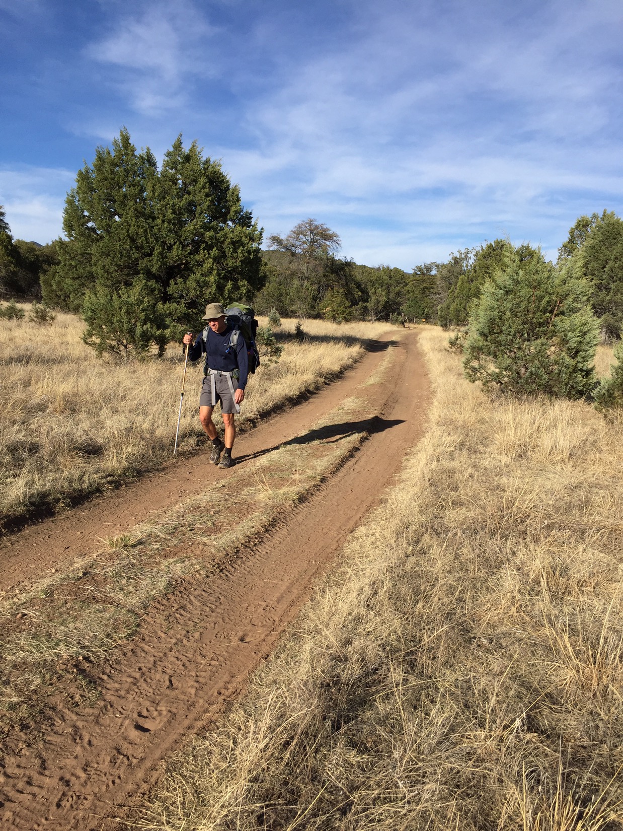
or us at the Stage Stop Hotel in town. The trail ended 3 1/2 miles outside of town, but as we walked down the two lane highway, we were as happy as two kids walking home from an afternoon of fishing.
Patagonia is tiny even by Arizona standards. Its initial reason for existence was the mining boom of 100 some odd years ago, and now about 900 people live scattered around the valley in homes new and old. The writer Jim Harrison lived here until he died a few weeks ago. If you know his philosophy about life, you’ve got a good sense of Patagonia. It’s a good place. Good vibe. There’s maybe 3-4 restaurants, an RV park, a school, some shops, and the Wagon Wheel.

After checking in, cleaning up, and dropping our packs, we went right for beers at the Wagon Wheel. I’m sure in the light of day it doesn’t seem like much, but that night it was the best damn bar in the world. We traded stories with a Canadian couple also hiking the trail, who told us among other things that they had run into Mexican refugees above Bathtub Spring the night after we had camped there. At 2am in the morning they heard steps and whispers, and when they poked their heads out of their tents three figures stopped and a voice tentatively asked in English, “No problem?”. “No problem,” they said, and the figures went on their way.

 Sleeping in a bed was as nice as I thought it would be, but both Chris and I woke up the next morning with sore backs anyway. We grabbed pancakes at the Gathering Grounds restaurant next door, said hi to he labs on the ATV, shouldered our packs and started down the road again to met my parents 7 miles out of town at the Temporal Gulch trailhead.

March 4th & 5th: The Canelo Hills

Day 3 & 4: Bad Water in Cowboy Country

We woke the second morning on the trail to learn (or recall) an important lesson: don’t camp in the bottom of a wash. All night we’d each felt a cold steady wind blowing through both our tents.

Dry country

After breaking camp, we hiked through starkly different landscape. The mountains (and the border patrol blimp) were gone, and we now walked through low rolling hills. Dry hills. We started to notice water much more, and started to plan our days around where we could reliably find it.

We drank at some of the funkiest spots I could imagine. Because we filtered, we drank from anything: trickling streams, puddles, stock tanks or streams green with algae bloom. The process: stop, remove backpack (not easily done), fill filter bag with stream water, filter into larger drinking bladder, repeat until bag filled then fill yourself “until you sloshed”. We averaged about 4-5 liters of water a day.

img_1334

We got less choosy about our camping spots. As long as it was roughly flat, off the trail and not in a wash, we flopped down. The first night in the Canelo Hills was actually pretty nice, but on the second night (in Red Rock Canyon), flat ground was impossible to find so we ended up camping amongst the thorn bushes by the creek. Our camp looked like those of the Chiracahua Apaches in the old photos of Arizona in the 1800’s – just not very cozy.

Our camp was a lot like this: maybe not as cozy

But the country was beautiful and we were getting close to a key goal: Patagonia the next day. As we crested the last of the hills and descended through Red Rock Canyon we knew we were only a few miles away from a pretty small town where a shower, soft bed and cold beer awaited us. The canyon widened and was dotted with small ranches, windmills and cattle tanks. Sleeping amongst the thorn trees wasn’t so bad.

March 3: The Huachucas

Day 2: The Eye of Sauron

We woke on our first morning on the trail and compared notes. What was the best way to sleep in a mummy sleeping bag in freezing weather? Lessons setting up a tent at the end of a long day? Already Chris is showing his superior organizational skills – while I am still fiddling with tent poles he already has his tent up, his sleeping bag and pad out and his stove organized and ready.

The good news, no more snow. Everything is downhill from here. The Huachucas are hard to hike but the views over Arizona and Mexico are endless. We descend just as rapidly as we ascended the day before. It’s a bit rough on our knees, quads and toenails, but we’re smart and we don’t push it. By the afternoon we’re in Sunnyside Canyon and the trail turns into a dirt road that follows a creek. Wild HUGE turkeys. The day before we had seen one solo hiker, but today we see no other human beings.

The guide had warned us that the trail was often used by refugees, with the most common activity at mile 8.5 above bathtub spring, exactly where we had camped. Although we later learned that other hikers had seen them (more on that when we get to Patagonia), Chris and I saw noone. We knew we were being watched however. In addition to the giant towers we had seen on the first day, the border patrol had a giant blimp that drifted over the mountains. At first we thought it was fixed over Miller Peak, but later realized that it moved slightly day to day. As we descended through Sunnyside Canyon the mountains disappeared, but we could see the blimp (and we assumed it could see us) the rest of the day. Chris dubbed it “The Eye of Sauron”.
By the late afternoon we’d descended almost all the way to the bottom of Parker Lake. The road turned into a deeply rutted two lane road, with rust red dirt that had been hiked for so long that it was soft like silt beneath our boots. In every way it seemed familiar to us – passing through the gates, the plumes of dust as we stepped, the smell of oak in the canyon. We stopped at a beautiful little wash off the main trail – about a mile from Parker Lake – and made camp for the night.


March 2: The Border

Day 1: Montezuma Pass

Even with 76 years of living in Arizona between the three of us, we were impressed.

It’s bit before 9am, and my dad, brother and I are standing in the parking lot of Montezuma’s Pass looking southwest. Below us the foothills of the Huachuca Mountains roll out in waves across the border with Mexico. We can’t tell where the US ends and Mexico begins.

img_1254
US Border Patrol truck lurking behind them

The parking lot is empty except for two US Border Patrol trucks jacked up with front wheels off the ground, giant telescopic poles rising out of their cargo-holds. Each pole is topped with a camera that can swivel in every direction. Kind of spooky.

Dad had picked my brother Chris and I up before sunrise that morning, and we had made the two hour drive down to the pass together. Chris and I had packed the night before – gear sprawled out on the floor like a photo in one of Colin Fletcher’s books – but we secretly hoped Dad would take the “pick us up at 6am” request loosely.

img_1251
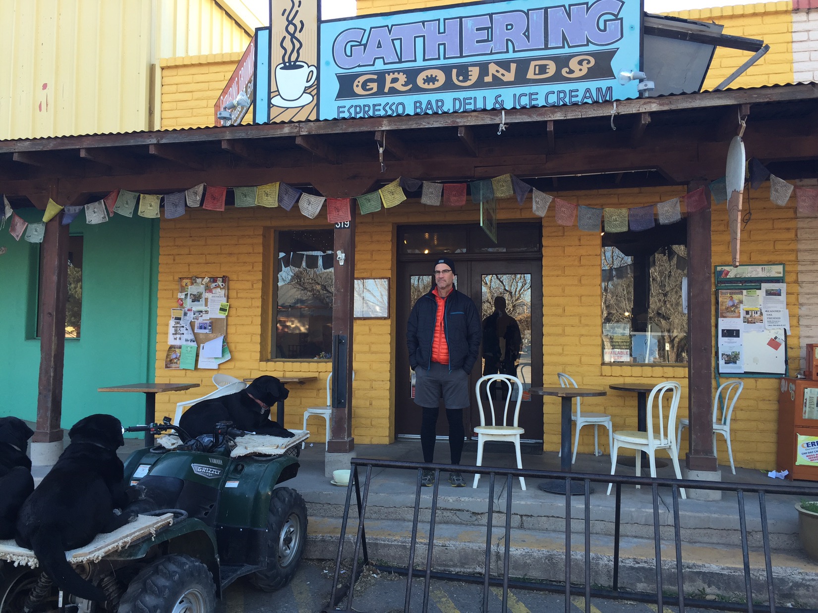
Dad never takes pickup directions loosely. We grabbed coffee while driving out of Tucson in the darkness.

At the pass we did a final backpack check, took photos and said goodbye. Dad drove down the canyon to head home, and Chris and I hit the trail. We started by going backwards, heading 1.7 miles south to a monument and barbed wire fence that marked the border with Mexico and the official start of the Arizona Trail. Then back north. The camera on one of the border Patrol trucks swiveled to watch us when we walked back through the lot again and headed into the Huachucas.

img_1256
Donald is not happy with this part of the border fence

It was a brutal first day. We climbed almost three thousand feet in less than 6 miles – going from 6,000 feet to 9,000 feet. We told each other to take it slow, that today was just the first of five straight days of hiking with 40 pound packs, that the only failure would be doing some dumb. Within five hours of starting our hike, we could still clearly see the parking lot where Dad had dropped us off that morning.

But we kept at it and it got better. We climbed through several different climate zones until finally by late afternoon we were leveling out at 9000 feet in the ponderosa pines and fir trees that are typical of the high mountains in southern Arizona. We were slowed by some hard-packed, crusty snow on the trail that made us place each foot carefully in front of the next for about a mile, so we didn’t hit camp above Bathtub Spring until the sun was dipping below the horizon. But we made it.

img_1277
Bathtub Spring

The water in Bathtub Spring drips from a faucet into an old bathtub by the side of the trail. It doesn’t look like much, with green algae lining the sides of the tub, but in the desert green means life (and good water). We each carried a Sawyer mini filter to filter every drop of water before we drank it just in case. First day of the Trail down: life is good.