March 4th & 5th: The Canelo Hills

Day 3 & 4: Bad Water in Cowboy Country

We woke the second morning on the trail to learn (or recall) an important lesson: don’t camp in the bottom of a wash. All night we’d each felt a cold steady wind blowing through both our tents.

Dry country

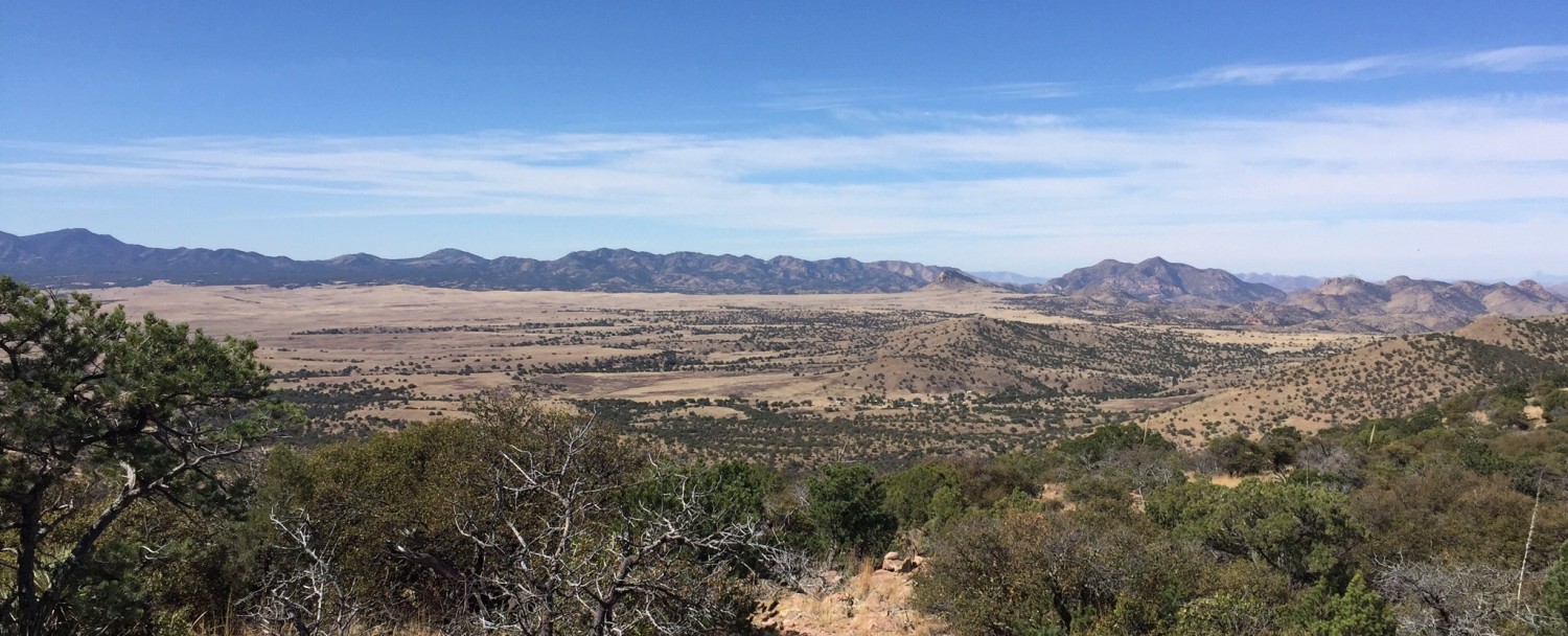
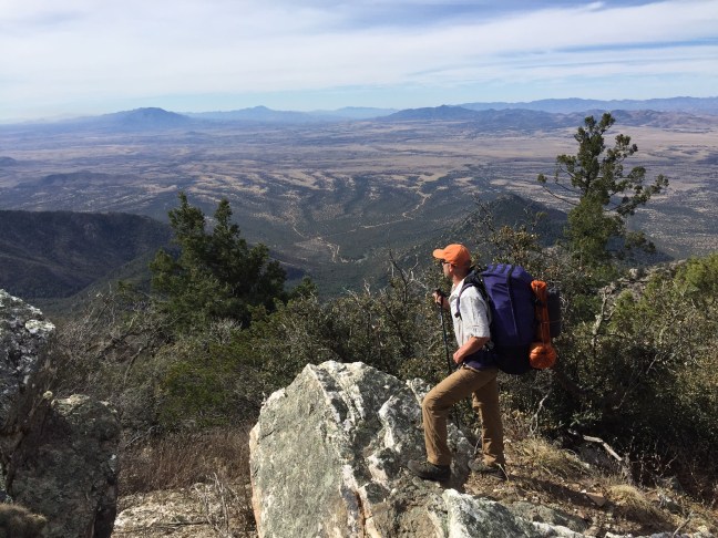
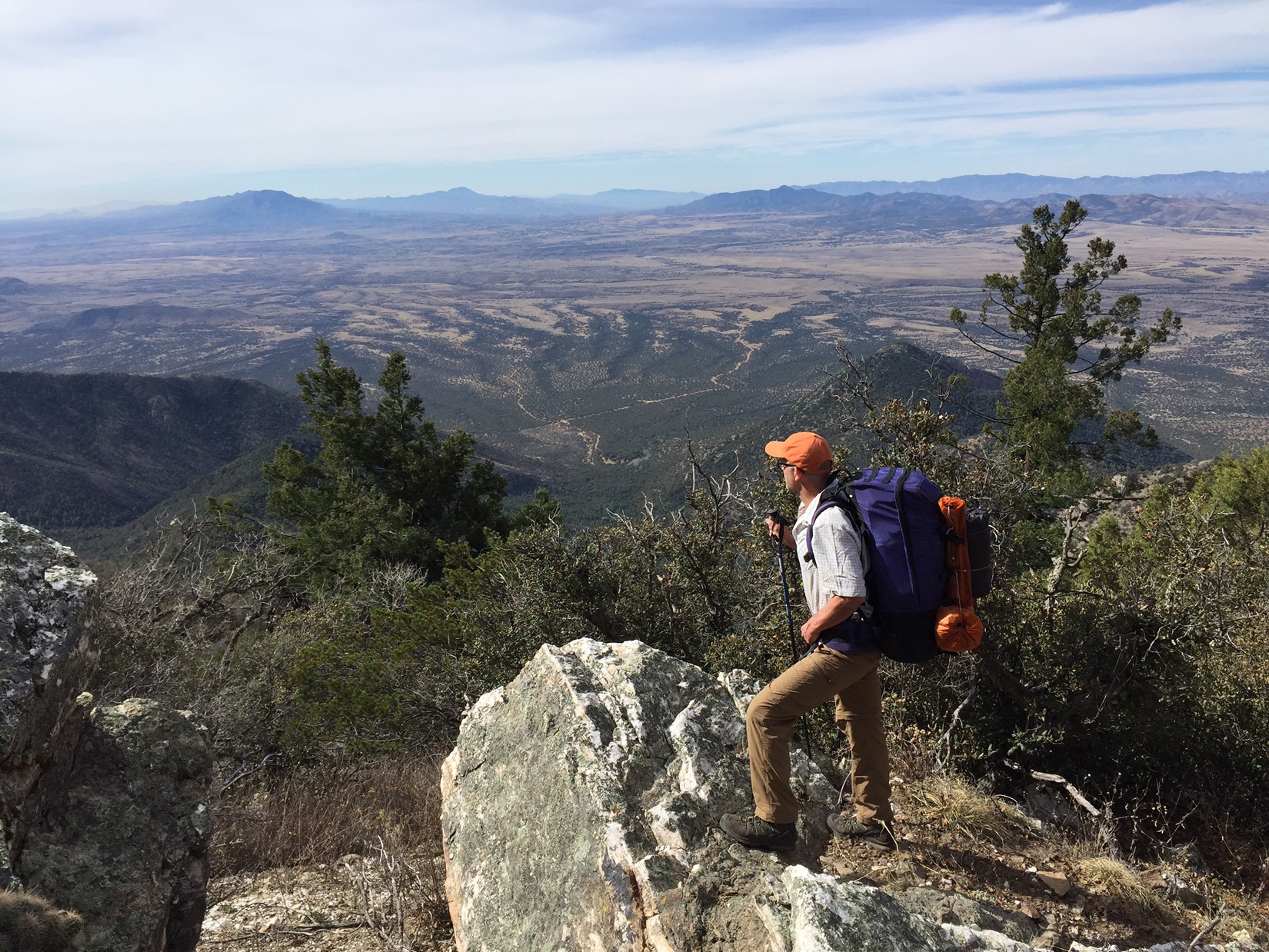
After breaking camp, we hiked through starkly different landscape. The mountains (and the border patrol blimp) were gone, and we now walked through low rolling hills. Dry hills. We started to notice water much more, and started to plan our days around where we could reliably find it.

We drank at some of the funkiest spots I could imagine. Because we filtered, we drank from anything: trickling streams, puddles, stock tanks or streams green with algae bloom. The process: stop, remove backpack (not easily done), fill filter bag with stream water, filter into larger drinking bladder, repeat until bag filled then fill yourself “until you sloshed”. We averaged about 4-5 liters of water a day.

img_1334

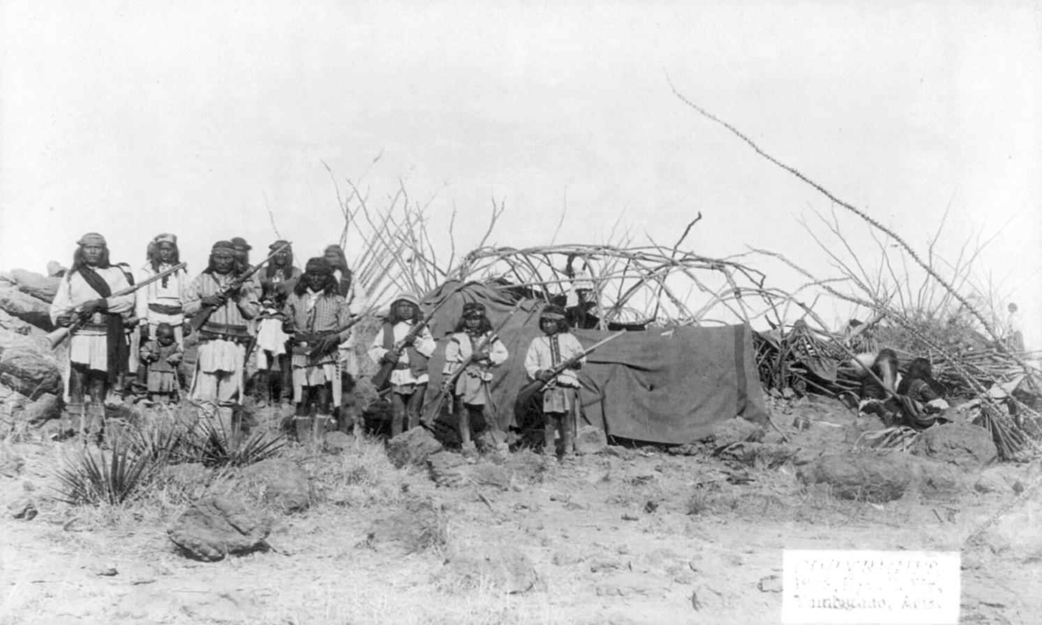
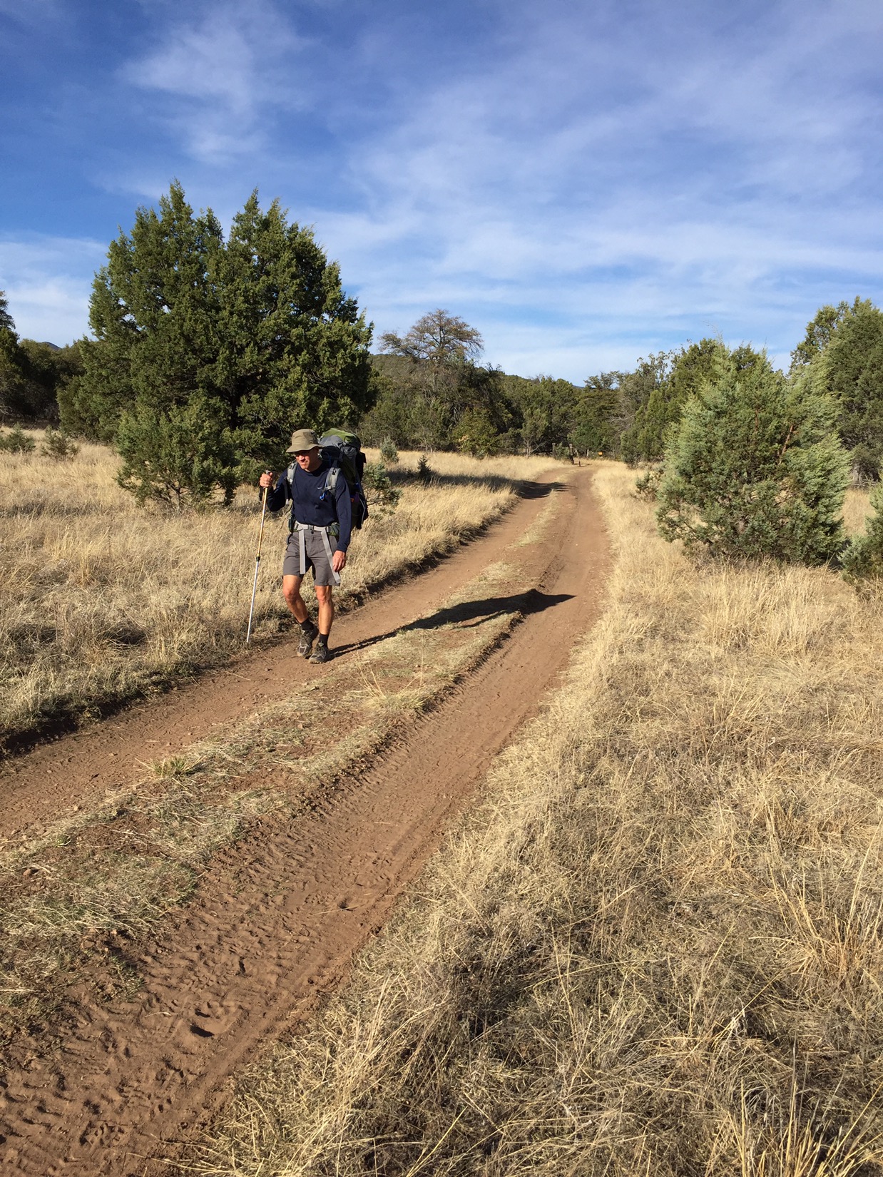
We got less choosy about our camping spots. As long as it was roughly flat, off the trail and not in a wash, we flopped down. The first night in the Canelo Hills was actually pretty nice, but on the second night (in Red Rock Canyon), flat ground was impossible to find so we ended up camping amongst the thorn bushes by the creek. Our camp looked like those of the Chiracahua Apaches in the old photos of Arizona in the 1800’s – just not very cozy.

Our camp was a lot like this: maybe not as cozy

But the country was beautiful and we were getting close to a key goal: Patagonia the next day. As we crested the last of the hills and descended through Red Rock Canyon we knew we were only a few miles away from a pretty small town where a shower, soft bed and cold beer awaited us. The canyon widened and was dotted with small ranches, windmills and cattle tanks. Sleeping amongst the thorn trees wasn’t so bad.

March 3: The Huachucas

Day 2: The Eye of Sauron

We woke on our first morning on the trail and compared notes. What was the best way to sleep in a mummy sleeping bag in freezing weather? Lessons setting up a tent at the end of a long day? Already Chris is showing his superior organizational skills – while I am still fiddling with tent poles he already has his tent up, his sleeping bag and pad out and his stove organized and ready.

The good news, no more snow. Everything is downhill from here. The Huachucas are hard to hike but the views over Arizona and Mexico are endless. We descend just as rapidly as we ascended the day before. It’s a bit rough on our knees, quads and toenails, but we’re smart and we don’t push it. By the afternoon we’re in Sunnyside Canyon and the trail turns into a dirt road that follows a creek. Wild HUGE turkeys. The day before we had seen one solo hiker, but today we see no other human beings.

The guide had warned us that the trail was often used by refugees, with the most common activity at mile 8.5 above bathtub spring, exactly where we had camped. Although we later learned that other hikers had seen them (more on that when we get to Patagonia), Chris and I saw noone. We knew we were being watched however. In addition to the giant towers we had seen on the first day, the border patrol had a giant blimp that drifted over the mountains. At first we thought it was fixed over Miller Peak, but later realized that it moved slightly day to day. As we descended through Sunnyside Canyon the mountains disappeared, but we could see the blimp (and we assumed it could see us) the rest of the day. Chris dubbed it “The Eye of Sauron”.
By the late afternoon we’d descended almost all the way to the bottom of Parker Lake. The road turned into a deeply rutted two lane road, with rust red dirt that had been hiked for so long that it was soft like silt beneath our boots. In every way it seemed familiar to us – passing through the gates, the plumes of dust as we stepped, the smell of oak in the canyon. We stopped at a beautiful little wash off the main trail – about a mile from Parker Lake – and made camp for the night.


March 2: The Border

Day 1: Montezuma Pass

Even with 76 years of living in Arizona between the three of us, we were impressed.

It’s bit before 9am, and my dad, brother and I are standing in the parking lot of Montezuma’s Pass looking southwest. Below us the foothills of the Huachuca Mountains roll out in waves across the border with Mexico. We can’t tell where the US ends and Mexico begins.

img_1254
US Border Patrol truck lurking behind them

The parking lot is empty except for two US Border Patrol trucks jacked up with front wheels off the ground, giant telescopic poles rising out of their cargo-holds. Each pole is topped with a camera that can swivel in every direction. Kind of spooky.

Dad had picked my brother Chris and I up before sunrise that morning, and we had made the two hour drive down to the pass together. Chris and I had packed the night before – gear sprawled out on the floor like a photo in one of Colin Fletcher’s books – but we secretly hoped Dad would take the “pick us up at 6am” request loosely.

img_1251Dad never takes pickup directions loosely. We grabbed coffee while driving out of Tucson in the darkness.

At the pass we did a final backpack check, took photos and said goodbye. Dad drove down the canyon to head home, and Chris and I hit the trail. We started by going backwards, heading 1.7 miles south to a monument and barbed wire fence that marked the border with Mexico and the official start of the Arizona Trail. Then back north. The camera on one of the border Patrol trucks swiveled to watch us when we walked back through the lot again and headed into the Huachucas.

img_1256
Donald is not happy with this part of the border fence

It was a brutal first day. We climbed almost three thousand feet in less than 6 miles – going from 6,000 feet to 9,000 feet. We told each other to take it slow, that today was just the first of five straight days of hiking with 40 pound packs, that the only failure would be doing some dumb. Within five hours of starting our hike, we could still clearly see the parking lot where Dad had dropped us off that morning.

But we kept at it and it got better. We climbed through several different climate zones until finally by late afternoon we were leveling out at 9000 feet in the ponderosa pines and fir trees that are typical of the high mountains in southern Arizona. We were slowed by some hard-packed, crusty snow on the trail that made us place each foot carefully in front of the next for about a mile, so we didn’t hit camp above Bathtub Spring until the sun was dipping below the horizon. But we made it.

img_1277
Bathtub Spring

The water in Bathtub Spring drips from a faucet into an old bathtub by the side of the trail. It doesn’t look like much, with green algae lining the sides of the tub, but in the desert green means life (and good water). We each carried a Sawyer mini filter to filter every drop of water before we drank it just in case. First day of the Trail down: life is good.